You are here: Home > Network List > GS - US Geological Survey Networks Stations List
> Station KAN13 Rinehart Farm, , CA, USA > Earthquake Result Viewer
KAN13 Rinehart Farm, , CA, USA - Earthquake Result Viewer
*The percent match for this event was below the threshold and hence no stack was calculated.
| Earthquake location: |
Northern Mid-Atlantic Ridge |
| Earthquake latitude/longitude: |
21.1/-45.9 |
| Earthquake time(UTC): |
2015/08/14 (226) 18:03:03 GMT |
| Earthquake Depth: |
13 km |
| Earthquake Magnitude: |
5.5 MB |
| Earthquake Catalog/Contributor: |
NEIC PDE/NEIC COMCAT |
|
| Network: |
GS US Geological Survey Networks |
| Station: |
KAN13 Rinehart Farm, , CA, USA |
| Lat/Lon: |
37.01 N/97.48 W |
| Elevation: |
340 m |
|
| Distance: |
47.2 deg |
| Az: |
301.314 deg |
| Baz: |
94.765 deg |
| Ray Param: |
$rayparam |
*The percent match for this event was below the threshold and hence was not used in the summary stack. |
|
| Radial Match: |
45.292294 % |
| Radial Bump: |
400 |
| Transverse Match: |
34.053185 % |
| Transverse Bump: |
400 |
| SOD ConfigId: |
1085051 |
| Insert Time: |
2015-08-28 18:37:34.443 +0000 |
| GWidth: |
2.5 |
| Max Bumps: |
400 |
| Tol: |
0.001 |
|
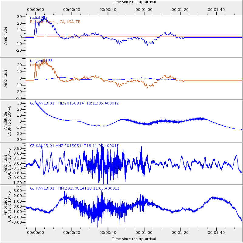
Signal To Noise
| Channel | StoN | STA | LTA |
| GS:KAN13:01:HHZ:20150814T18:11:05.40001Z | 5.5257297 | 4.4637724E-7 | 8.07816E-8 |
| GS:KAN13:01:HHN:20150814T18:11:05.40001Z | 1.0657538 | 3.032609E-7 | 2.845506E-7 |
| GS:KAN13:01:HHE:20150814T18:11:05.40001Z | 1.6670405 | 1.454056E-5 | 8.72238E-6 |
| Arrivals |
| Ps | |
| PpPs | |
| PsPs/PpSs | |


