You are here: Home > Network List > TA - USArray Transportable Network (new EarthScope stations) Stations List
> Station L20K Farewell, AK, USA > Earthquake Result Viewer
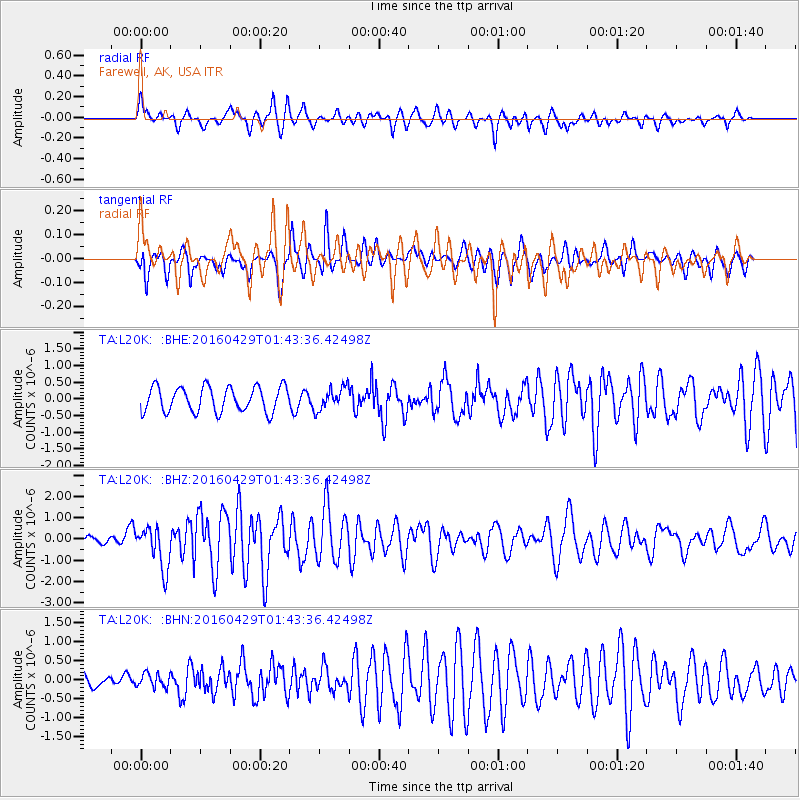
L20K Farewell, AK, USA - Earthquake Result Viewer
*The percent match for this event was below the threshold and hence no stack was calculated.
| Earthquake location: |
Northern East Pacific Rise |
| Earthquake latitude/longitude: |
10.3/-103.8 |
| Earthquake time(UTC): |
2016/04/29 (120) 01:33:38 GMT |
| Earthquake Depth: |
10 km |
| Earthquake Magnitude: |
6.8 MWP, 6.9 MI |
| Earthquake Catalog/Contributor: |
NEIC PDE/NEIC COMCAT |
|
| Network: |
TA USArray Transportable Network (new EarthScope stations) |
| Station: |
L20K Farewell, AK, USA |
| Lat/Lon: |
62.48 N/153.88 W |
| Elevation: |
673 m |
|
| Distance: |
63.3 deg |
| Az: |
336.478 deg |
| Baz: |
122.261 deg |
| Ray Param: |
$rayparam |
*The percent match for this event was below the threshold and hence was not used in the summary stack. |
|
| Radial Match: |
74.1389 % |
| Radial Bump: |
336 |
| Transverse Match: |
63.253784 % |
| Transverse Bump: |
400 |
| SOD ConfigId: |
7422571 |
| Insert Time: |
2019-04-22 12:11:06.279 +0000 |
| GWidth: |
2.5 |
| Max Bumps: |
400 |
| Tol: |
0.001 |
|
Signal To Noise
| Channel | StoN | STA | LTA |
| TA:L20K: :BHZ:20160429T01:43:36.42498Z | 6.5124235 | 9.949846E-7 | 1.5278253E-7 |
| TA:L20K: :BHN:20160429T01:43:36.42498Z | 0.80480754 | 1.7893764E-7 | 2.2233593E-7 |
| TA:L20K: :BHE:20160429T01:43:36.42498Z | 0.89603364 | 3.3722884E-7 | 3.7635735E-7 |
| Arrivals |
| Ps | |
| PpPs | |
| PsPs/PpSs | |


