You are here: Home > Network List > UW - Pacific Northwest Regional Seismic Network Stations List
> Station MRBL Marblemount, WA, USA > Earthquake Result Viewer
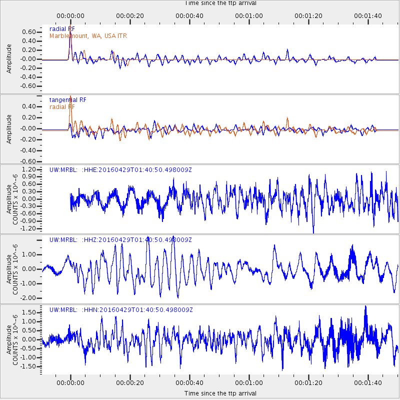
MRBL Marblemount, WA, USA - Earthquake Result Viewer
*The percent match for this event was below the threshold and hence no stack was calculated.
| Earthquake location: |
Northern East Pacific Rise |
| Earthquake latitude/longitude: |
10.3/-103.8 |
| Earthquake time(UTC): |
2016/04/29 (120) 01:33:38 GMT |
| Earthquake Depth: |
10 km |
| Earthquake Magnitude: |
6.8 MWP, 6.9 MI |
| Earthquake Catalog/Contributor: |
NEIC PDE/NEIC COMCAT |
|
| Network: |
UW Pacific Northwest Regional Seismic Network |
| Station: |
MRBL Marblemount, WA, USA |
| Lat/Lon: |
48.52 N/121.48 W |
| Elevation: |
75 m |
|
| Distance: |
40.9 deg |
| Az: |
342.008 deg |
| Baz: |
152.79 deg |
| Ray Param: |
$rayparam |
*The percent match for this event was below the threshold and hence was not used in the summary stack. |
|
| Radial Match: |
74.85154 % |
| Radial Bump: |
400 |
| Transverse Match: |
66.22063 % |
| Transverse Bump: |
400 |
| SOD ConfigId: |
7422571 |
| Insert Time: |
2019-04-22 12:12:00.137 +0000 |
| GWidth: |
2.5 |
| Max Bumps: |
400 |
| Tol: |
0.001 |
|
Signal To Noise
| Channel | StoN | STA | LTA |
| UW:MRBL: :HHZ:20160429T01:40:50.498009Z | 3.8699236 | 6.1713206E-7 | 1.594688E-7 |
| UW:MRBL: :HHN:20160429T01:40:50.498009Z | 1.8714576 | 3.8079256E-7 | 2.0347379E-7 |
| UW:MRBL: :HHE:20160429T01:40:50.498009Z | 1.5149258 | 3.9135446E-7 | 2.5833242E-7 |
| Arrivals |
| Ps | |
| PpPs | |
| PsPs/PpSs | |


