NEE2 Needles Airport - Earthquake Result Viewer
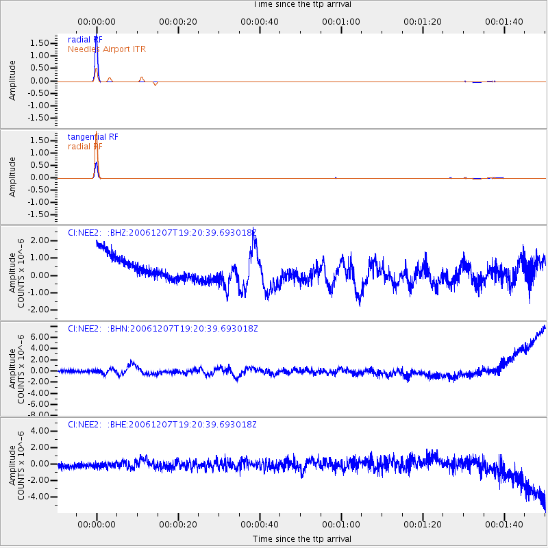
Earthquake location: East Of Kuril Islands
Earthquake latitude/longitude: 46.2/154.4
Earthquake time(UTC): 2006/12/07 (341) 19:10:21 GMT
Earthquake Depth: 16 km
Earthquake Magnitude: 6.3 MB, 6.1 MS, 6.3 MW, 6.3 MW
Earthquake Catalog/Contributor: WHDF/NEIC
Network: CI Caltech Regional Seismic Network
Station: NEE2 Needles Airport
Lat/Lon: 34.77 N/114.62 W
Elevation: 271 m
Distance: 66.5 deg
Az: 63.808 deg
Baz: 310.739 deg
Ray Param: 0.057537355
Estimated Moho Depth: 10.0 km
Estimated Crust Vp/Vs: 1.60
Assumed Crust Vp: 6.276 km/s
Estimated Crust Vs: 3.922 km/s
Estimated Crust Poisson's Ratio: 0.18
Radial Match: 99.83079 %
Radial Bump: 16
Transverse Match: 99.50393 %
Transverse Bump: 26
SOD ConfigId: 2564
Insert Time: 2010-02-26 00:20:34.171 +0000
GWidth: 2.5
Max Bumps: 400
Tol: 0.001

Signal To Noise

ChannelStoNSTALTA
CI:NEE2: :BHN:20061207T19:20:39.693018Z0.995322356.9482843E-76.9809386E-7
CI:NEE2: :BHE:20061207T19:20:39.693018Z0.84885553.0979538E-73.6495655E-7
CI:NEE2: :BHZ:20061207T19:20:39.693018Z1.27036087.9854266E-76.2859516E-7
Arrivals
Ps1.0 SECOND
PpPs4.0 SECOND
PsPs/PpSs5.0 SECOND