You are here: Home > Network List > TA - USArray Transportable Network (new EarthScope stations) Stations List
> Station I23K Minto, Yukon-Koyukuk, AK, USA > Earthquake Result Viewer
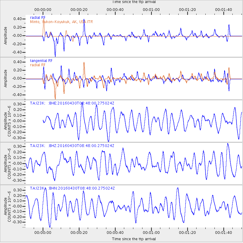
I23K Minto, Yukon-Koyukuk, AK, USA - Earthquake Result Viewer
*The percent match for this event was below the threshold and hence no stack was calculated.
| Earthquake location: |
Vanuatu Islands |
| Earthquake latitude/longitude: |
-16.3/167.2 |
| Earthquake time(UTC): |
2016/04/30 (121) 08:35:42 GMT |
| Earthquake Depth: |
4.7 km |
| Earthquake Magnitude: |
6.0 MO |
| Earthquake Catalog/Contributor: |
NEIC PDE/NEIC ALERT |
|
| Network: |
TA USArray Transportable Network (new EarthScope stations) |
| Station: |
I23K Minto, Yukon-Koyukuk, AK, USA |
| Lat/Lon: |
65.15 N/149.36 W |
| Elevation: |
149 m |
|
| Distance: |
87.6 deg |
| Az: |
16.912 deg |
| Baz: |
221.377 deg |
| Ray Param: |
$rayparam |
*The percent match for this event was below the threshold and hence was not used in the summary stack. |
|
| Radial Match: |
58.688923 % |
| Radial Bump: |
250 |
| Transverse Match: |
49.92311 % |
| Transverse Bump: |
345 |
| SOD ConfigId: |
7422571 |
| Insert Time: |
2019-04-22 12:17:34.177 +0000 |
| GWidth: |
2.5 |
| Max Bumps: |
400 |
| Tol: |
0.001 |
|
Signal To Noise
| Channel | StoN | STA | LTA |
| TA:I23K: :BHZ:20160430T08:48:00.275024Z | 1.1023558 | 1.2994202E-7 | 1.17876645E-7 |
| TA:I23K: :BHN:20160430T08:48:00.275024Z | 2.0520234 | 2.5414948E-7 | 1.2385311E-7 |
| TA:I23K: :BHE:20160430T08:48:00.275024Z | 1.2794024 | 1.5318838E-7 | 1.1973432E-7 |
| Arrivals |
| Ps | |
| PpPs | |
| PsPs/PpSs | |


