You are here: Home > Network List > KN - Kyrgyz Seismic Telemetry Network Stations List
> Station CHM KN.CHM > Earthquake Result Viewer
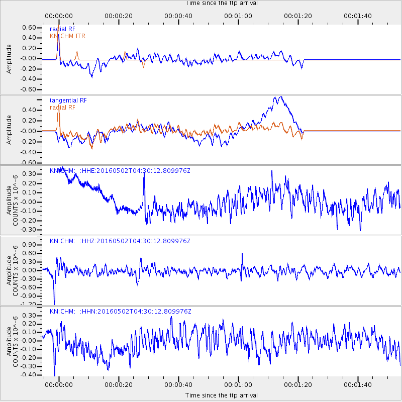
CHM KN.CHM - Earthquake Result Viewer
*The percent match for this event was below the threshold and hence no stack was calculated.
| Earthquake location: |
Southern Sumatra, Indonesia |
| Earthquake latitude/longitude: |
-5.0/104.6 |
| Earthquake time(UTC): |
2016/05/02 (123) 04:21:24 GMT |
| Earthquake Depth: |
117 km |
| Earthquake Magnitude: |
5.7 MWW, 5.7 MWB, 5.7 MWC |
| Earthquake Catalog/Contributor: |
NEIC PDE/NEIC COMCAT |
|
| Network: |
KN Kyrgyz Seismic Telemetry Network |
| Station: |
CHM KN.CHM |
| Lat/Lon: |
43.00 N/74.75 E |
| Elevation: |
655 m |
|
| Distance: |
54.9 deg |
| Az: |
333.479 deg |
| Baz: |
142.676 deg |
| Ray Param: |
$rayparam |
*The percent match for this event was below the threshold and hence was not used in the summary stack. |
|
| Radial Match: |
55.13682 % |
| Radial Bump: |
400 |
| Transverse Match: |
27.414942 % |
| Transverse Bump: |
400 |
| SOD ConfigId: |
7422571 |
| Insert Time: |
2019-04-22 12:22:04.793 +0000 |
| GWidth: |
2.5 |
| Max Bumps: |
400 |
| Tol: |
0.001 |
|
Signal To Noise
| Channel | StoN | STA | LTA |
| KN:CHM: :HHZ:20160502T04:30:12.809976Z | 7.509802 | 2.0660306E-7 | 2.751112E-8 |
| KN:CHM: :HHN:20160502T04:30:12.809976Z | 1.415542 | 1.6447596E-7 | 1.1619292E-7 |
| KN:CHM: :HHE:20160502T04:30:12.809976Z | 1.5965289 | 2.282853E-7 | 1.4298851E-7 |
| Arrivals |
| Ps | |
| PpPs | |
| PsPs/PpSs | |


