You are here: Home > Network List > TA - USArray Transportable Network (new EarthScope stations) Stations List
> Station J20K Nowitna River, AK, USA > Earthquake Result Viewer
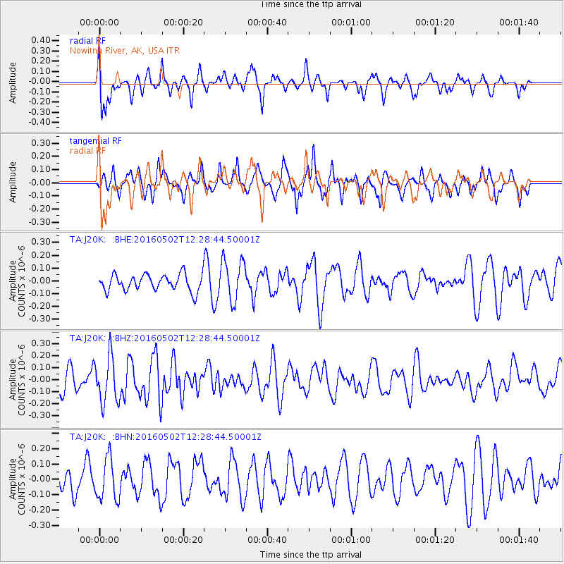
J20K Nowitna River, AK, USA - Earthquake Result Viewer
*The percent match for this event was below the threshold and hence no stack was calculated.
| Earthquake location: |
Central East Pacific Rise |
| Earthquake latitude/longitude: |
-6.1/-107.2 |
| Earthquake time(UTC): |
2016/05/02 (123) 12:17:16 GMT |
| Earthquake Depth: |
15 km |
| Earthquake Magnitude: |
5.6 Mwc |
| Earthquake Catalog/Contributor: |
NEIC PDE/us |
|
| Network: |
TA USArray Transportable Network (new EarthScope stations) |
| Station: |
J20K Nowitna River, AK, USA |
| Lat/Lon: |
64.18 N/154.15 W |
| Elevation: |
314 m |
|
| Distance: |
78.3 deg |
| Az: |
340.913 deg |
| Baz: |
132.056 deg |
| Ray Param: |
$rayparam |
*The percent match for this event was below the threshold and hence was not used in the summary stack. |
|
| Radial Match: |
53.478313 % |
| Radial Bump: |
369 |
| Transverse Match: |
63.212246 % |
| Transverse Bump: |
323 |
| SOD ConfigId: |
7422571 |
| Insert Time: |
2019-04-22 12:31:26.244 +0000 |
| GWidth: |
2.5 |
| Max Bumps: |
400 |
| Tol: |
0.001 |
|
Signal To Noise
| Channel | StoN | STA | LTA |
| TA:J20K: :BHZ:20160502T12:28:44.50001Z | 2.0666506 | 1.9499807E-7 | 9.435463E-8 |
| TA:J20K: :BHN:20160502T12:28:44.50001Z | 1.5099852 | 1.3951639E-7 | 9.239586E-8 |
| TA:J20K: :BHE:20160502T12:28:44.50001Z | 2.5754547 | 1.6500748E-7 | 6.406926E-8 |
| Arrivals |
| Ps | |
| PpPs | |
| PsPs/PpSs | |


