You are here: Home > Network List > WY - Yellowstone Wyoming Seismic Network Stations List
> Station YUF Upper Falls, WY, USA > Earthquake Result Viewer
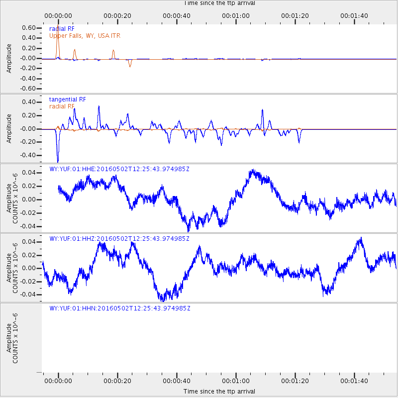
YUF Upper Falls, WY, USA - Earthquake Result Viewer
*The percent match for this event was below the threshold and hence no stack was calculated.
| Earthquake location: |
Central East Pacific Rise |
| Earthquake latitude/longitude: |
-6.1/-107.2 |
| Earthquake time(UTC): |
2016/05/02 (123) 12:17:16 GMT |
| Earthquake Depth: |
15 km |
| Earthquake Magnitude: |
5.6 Mwc |
| Earthquake Catalog/Contributor: |
NEIC PDE/us |
|
| Network: |
WY Yellowstone Wyoming Seismic Network |
| Station: |
YUF Upper Falls, WY, USA |
| Lat/Lon: |
44.71 N/110.51 W |
| Elevation: |
2394 m |
|
| Distance: |
50.6 deg |
| Az: |
356.913 deg |
| Baz: |
175.692 deg |
| Ray Param: |
$rayparam |
*The percent match for this event was below the threshold and hence was not used in the summary stack. |
|
| Radial Match: |
78.034096 % |
| Radial Bump: |
309 |
| Transverse Match: |
78.03734 % |
| Transverse Bump: |
312 |
| SOD ConfigId: |
7422571 |
| Insert Time: |
2019-04-22 12:32:40.831 +0000 |
| GWidth: |
2.5 |
| Max Bumps: |
400 |
| Tol: |
0.001 |
|
Signal To Noise
| Channel | StoN | STA | LTA |
| WY:YUF:01:HHZ:20160502T12:25:43.974985Z | 0.8680819 | 3.3883996E-8 | 3.9033175E-8 |
| $trig.getChannelId() | $trig.getValue() | $trig.getSTA() | $trig.getLTA() |
| WY:YUF:01:HHE:20160502T12:25:43.974985Z | 1.4348221 | 1.5270079E-8 | 1.064249E-8 |
| Arrivals |
| Ps | |
| PpPs | |
| PsPs/PpSs | |


