You are here: Home > Network List > IU - Global Seismograph Network (GSN - IRIS/USGS) Stations List
> Station GNI Garni, Armenia > Earthquake Result Viewer
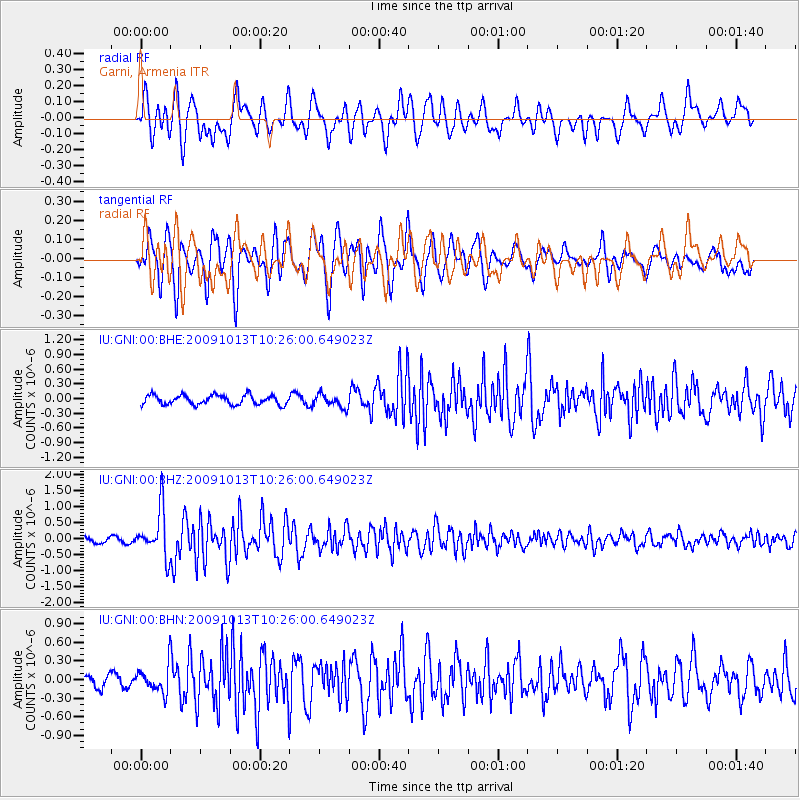
GNI Garni, Armenia - Earthquake Result Viewer
*The percent match for this event was below the threshold and hence no stack was calculated.
| Earthquake location: |
Kuril Islands |
| Earthquake latitude/longitude: |
44.6/149.1 |
| Earthquake time(UTC): |
2009/10/13 (286) 10:15:13 GMT |
| Earthquake Depth: |
40 km |
| Earthquake Magnitude: |
5.6 MB, 5.2 MS, 5.7 MW, 5.6 MW |
| Earthquake Catalog/Contributor: |
WHDF/NEIC |
|
| Network: |
IU Global Seismograph Network (GSN - IRIS/USGS) |
| Station: |
GNI Garni, Armenia |
| Lat/Lon: |
40.15 N/44.74 E |
| Elevation: |
1609 m |
|
| Distance: |
71.8 deg |
| Az: |
308.576 deg |
| Baz: |
46.793 deg |
| Ray Param: |
$rayparam |
*The percent match for this event was below the threshold and hence was not used in the summary stack. |
|
| Radial Match: |
77.50191 % |
| Radial Bump: |
400 |
| Transverse Match: |
77.51891 % |
| Transverse Bump: |
400 |
| SOD ConfigId: |
1 |
| Insert Time: |
2010-02-19 00:44:57.895 +0000 |
| GWidth: |
2.5 |
| Max Bumps: |
400 |
| Tol: |
0.001 |
|
Signal To Noise
| Channel | StoN | STA | LTA |
| IU:GNI:00:BHZ:20091013T10:26:00.649023Z | 8.972018 | 7.2722395E-7 | 8.1054665E-8 |
| IU:GNI:00:BHN:20091013T10:26:00.649023Z | 2.7405605 | 2.2348756E-7 | 8.154812E-8 |
| IU:GNI:00:BHE:20091013T10:26:00.649023Z | 1.4174471 | 1.3672381E-7 | 9.645779E-8 |
| Arrivals |
| Ps | |
| PpPs | |
| PsPs/PpSs | |


