You are here: Home > Network List > CN - Canadian National Seismograph Network Stations List
> Station FRB IQALUIT, N.W.T. > Earthquake Result Viewer
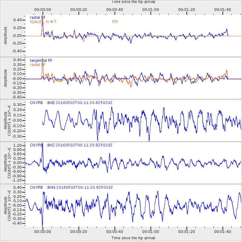
FRB IQALUIT, N.W.T. - Earthquake Result Viewer
*The percent match for this event was below the threshold and hence no stack was calculated.
| Earthquake location: |
Kuril Islands |
| Earthquake latitude/longitude: |
43.7/147.5 |
| Earthquake time(UTC): |
2016/05/03 (124) 00:00:51 GMT |
| Earthquake Depth: |
61 km |
| Earthquake Magnitude: |
5.5 MB, 5.7 MWC, 5.7 MWB |
| Earthquake Catalog/Contributor: |
NEIC PDE/NEIC COMCAT |
|
| Network: |
CN Canadian National Seismograph Network |
| Station: |
FRB IQALUIT, N.W.T. |
| Lat/Lon: |
63.75 N/68.55 W |
| Elevation: |
18 m |
|
| Distance: |
69.2 deg |
| Az: |
16.264 deg |
| Baz: |
332.817 deg |
| Ray Param: |
$rayparam |
*The percent match for this event was below the threshold and hence was not used in the summary stack. |
|
| Radial Match: |
55.86749 % |
| Radial Bump: |
400 |
| Transverse Match: |
58.14136 % |
| Transverse Bump: |
398 |
| SOD ConfigId: |
7422571 |
| Insert Time: |
2019-04-22 12:36:37.775 +0000 |
| GWidth: |
2.5 |
| Max Bumps: |
400 |
| Tol: |
0.001 |
|
Signal To Noise
| Channel | StoN | STA | LTA |
| CN:FRB: :BHZ:20160503T00:11:20.825029Z | 6.4880733 | 4.6112294E-7 | 7.10724E-8 |
| CN:FRB: :BHN:20160503T00:11:20.825029Z | 1.6959367 | 1.7622314E-7 | 1.0390903E-7 |
| CN:FRB: :BHE:20160503T00:11:20.825029Z | 1.5739034 | 1.5026893E-7 | 9.5475315E-8 |
| Arrivals |
| Ps | |
| PpPs | |
| PsPs/PpSs | |


