You are here: Home > Network List > CN - Canadian National Seismograph Network Stations List
> Station INK INUVIK, NT > Earthquake Result Viewer
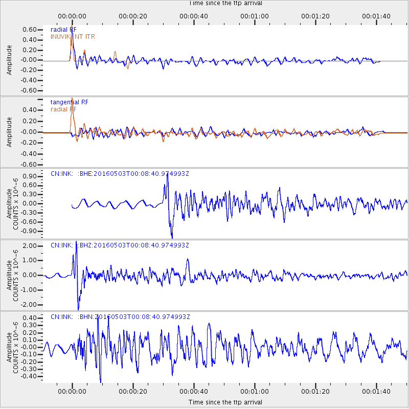
INK INUVIK, NT - Earthquake Result Viewer
*The percent match for this event was below the threshold and hence no stack was calculated.
| Earthquake location: |
Kuril Islands |
| Earthquake latitude/longitude: |
43.7/147.5 |
| Earthquake time(UTC): |
2016/05/03 (124) 00:00:51 GMT |
| Earthquake Depth: |
61 km |
| Earthquake Magnitude: |
5.5 MB, 5.7 MWC, 5.7 MWB |
| Earthquake Catalog/Contributor: |
NEIC PDE/NEIC COMCAT |
|
| Network: |
CN Canadian National Seismograph Network |
| Station: |
INK INUVIK, NT |
| Lat/Lon: |
68.31 N/133.53 W |
| Elevation: |
44 m |
|
| Distance: |
46.3 deg |
| Az: |
30.301 deg |
| Baz: |
280.115 deg |
| Ray Param: |
$rayparam |
*The percent match for this event was below the threshold and hence was not used in the summary stack. |
|
| Radial Match: |
79.111725 % |
| Radial Bump: |
400 |
| Transverse Match: |
67.684685 % |
| Transverse Bump: |
400 |
| SOD ConfigId: |
7422571 |
| Insert Time: |
2019-04-22 12:36:40.541 +0000 |
| GWidth: |
2.5 |
| Max Bumps: |
400 |
| Tol: |
0.001 |
|
Signal To Noise
| Channel | StoN | STA | LTA |
| CN:INK: :BHZ:20160503T00:08:40.974993Z | 9.561579 | 1.0807279E-6 | 1.1302818E-7 |
| CN:INK: :BHN:20160503T00:08:40.974993Z | 1.4057338 | 1.0433378E-7 | 7.4220154E-8 |
| CN:INK: :BHE:20160503T00:08:40.974993Z | 6.2605286 | 5.4093584E-7 | 8.640418E-8 |
| Arrivals |
| Ps | |
| PpPs | |
| PsPs/PpSs | |


