You are here: Home > Network List > US - United States National Seismic Network Stations List
> Station MSO Missoula, Montana, USA > Earthquake Result Viewer
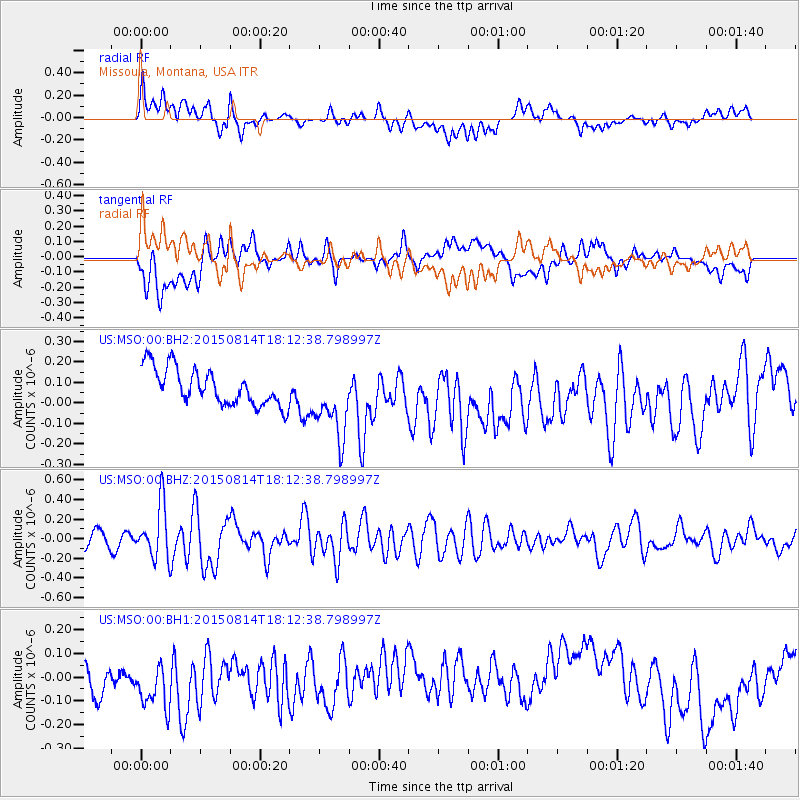
MSO Missoula, Montana, USA - Earthquake Result Viewer
*The percent match for this event was below the threshold and hence no stack was calculated.
| Earthquake location: |
Northern Mid-Atlantic Ridge |
| Earthquake latitude/longitude: |
21.1/-45.9 |
| Earthquake time(UTC): |
2015/08/14 (226) 18:03:03 GMT |
| Earthquake Depth: |
13 km |
| Earthquake Magnitude: |
5.5 MB |
| Earthquake Catalog/Contributor: |
NEIC PDE/NEIC COMCAT |
|
| Network: |
US United States National Seismic Network |
| Station: |
MSO Missoula, Montana, USA |
| Lat/Lon: |
46.83 N/113.94 W |
| Elevation: |
1264 m |
|
| Distance: |
60.0 deg |
| Az: |
312.662 deg |
| Baz: |
90.51 deg |
| Ray Param: |
$rayparam |
*The percent match for this event was below the threshold and hence was not used in the summary stack. |
|
| Radial Match: |
45.672573 % |
| Radial Bump: |
400 |
| Transverse Match: |
38.92069 % |
| Transverse Bump: |
400 |
| SOD ConfigId: |
1085051 |
| Insert Time: |
2015-08-28 18:45:33.001 +0000 |
| GWidth: |
2.5 |
| Max Bumps: |
400 |
| Tol: |
0.001 |
|
Signal To Noise
| Channel | StoN | STA | LTA |
| US:MSO:00:BHZ:20150814T18:12:38.798997Z | 4.027513 | 2.740036E-7 | 6.803295E-8 |
| US:MSO:00:BH1:20150814T18:12:38.798997Z | 1.8585461 | 1.5811129E-7 | 8.507257E-8 |
| US:MSO:00:BH2:20150814T18:12:38.798997Z | 1.9965181 | 1.7801852E-7 | 8.916449E-8 |
| Arrivals |
| Ps | |
| PpPs | |
| PsPs/PpSs | |


