You are here: Home > Network List > TA - USArray Transportable Network (new EarthScope stations) Stations List
> Station I23K Minto, Yukon-Koyukuk, AK, USA > Earthquake Result Viewer
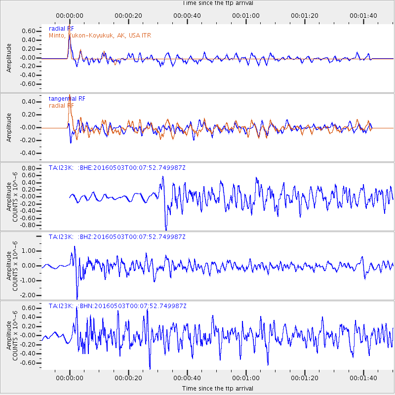
I23K Minto, Yukon-Koyukuk, AK, USA - Earthquake Result Viewer
*The percent match for this event was below the threshold and hence no stack was calculated.
| Earthquake location: |
Kuril Islands |
| Earthquake latitude/longitude: |
43.7/147.5 |
| Earthquake time(UTC): |
2016/05/03 (124) 00:00:51 GMT |
| Earthquake Depth: |
61 km |
| Earthquake Magnitude: |
5.5 MB, 5.7 MWC, 5.7 MWB |
| Earthquake Catalog/Contributor: |
NEIC PDE/NEIC COMCAT |
|
| Network: |
TA USArray Transportable Network (new EarthScope stations) |
| Station: |
I23K Minto, Yukon-Koyukuk, AK, USA |
| Lat/Lon: |
65.15 N/149.36 W |
| Elevation: |
149 m |
|
| Distance: |
40.3 deg |
| Az: |
35.629 deg |
| Baz: |
269.446 deg |
| Ray Param: |
$rayparam |
*The percent match for this event was below the threshold and hence was not used in the summary stack. |
|
| Radial Match: |
73.690094 % |
| Radial Bump: |
398 |
| Transverse Match: |
56.49183 % |
| Transverse Bump: |
400 |
| SOD ConfigId: |
7422571 |
| Insert Time: |
2019-04-22 12:41:14.100 +0000 |
| GWidth: |
2.5 |
| Max Bumps: |
400 |
| Tol: |
0.001 |
|
Signal To Noise
| Channel | StoN | STA | LTA |
| TA:I23K: :BHZ:20160503T00:07:52.749987Z | 8.926003 | 8.39913E-7 | 9.409732E-8 |
| TA:I23K: :BHN:20160503T00:07:52.749987Z | 2.4269335 | 2.3662408E-7 | 9.7499196E-8 |
| TA:I23K: :BHE:20160503T00:07:52.749987Z | 5.925563 | 4.1018686E-7 | 6.922327E-8 |
| Arrivals |
| Ps | |
| PpPs | |
| PsPs/PpSs | |


