You are here: Home > Network List > CI - Caltech Regional Seismic Network Stations List
> Station NEE2 Needles Airport > Earthquake Result Viewer
NEE2 Needles Airport - Earthquake Result Viewer

| Earthquake location: |
Kuril Islands |
| Earthquake latitude/longitude: |
44.2/146.8 |
| Earthquake time(UTC): |
2006/11/22 (326) 11:15:09 GMT |
| Earthquake Depth: |
80 km |
| Earthquake Magnitude: |
5.6 MB, 5.6 MW, 5.6 MW |
| Earthquake Catalog/Contributor: |
WHDF/NEIC |
|
| Network: |
CI Caltech Regional Seismic Network |
| Station: |
NEE2 Needles Airport |
| Lat/Lon: |
34.77 N/114.62 W |
| Elevation: |
271 m |
|
| Distance: |
72.2 deg |
| Az: |
58.746 deg |
| Baz: |
311.631 deg |
| Ray Param: |
0.05362565 |
| Estimated Moho Depth: |
10.0 km |
| Estimated Crust Vp/Vs: |
1.60 |
| Assumed Crust Vp: |
6.276 km/s |
| Estimated Crust Vs: |
3.922 km/s |
| Estimated Crust Poisson's Ratio: |
0.18 |
|
| Radial Match: |
99.99486 % |
| Radial Bump: |
2 |
| Transverse Match: |
99.98351 % |
| Transverse Bump: |
2 |
| SOD ConfigId: |
2564 |
| Insert Time: |
2010-02-26 00:20:43.750 +0000 |
| GWidth: |
2.5 |
| Max Bumps: |
400 |
| Tol: |
0.001 |
|
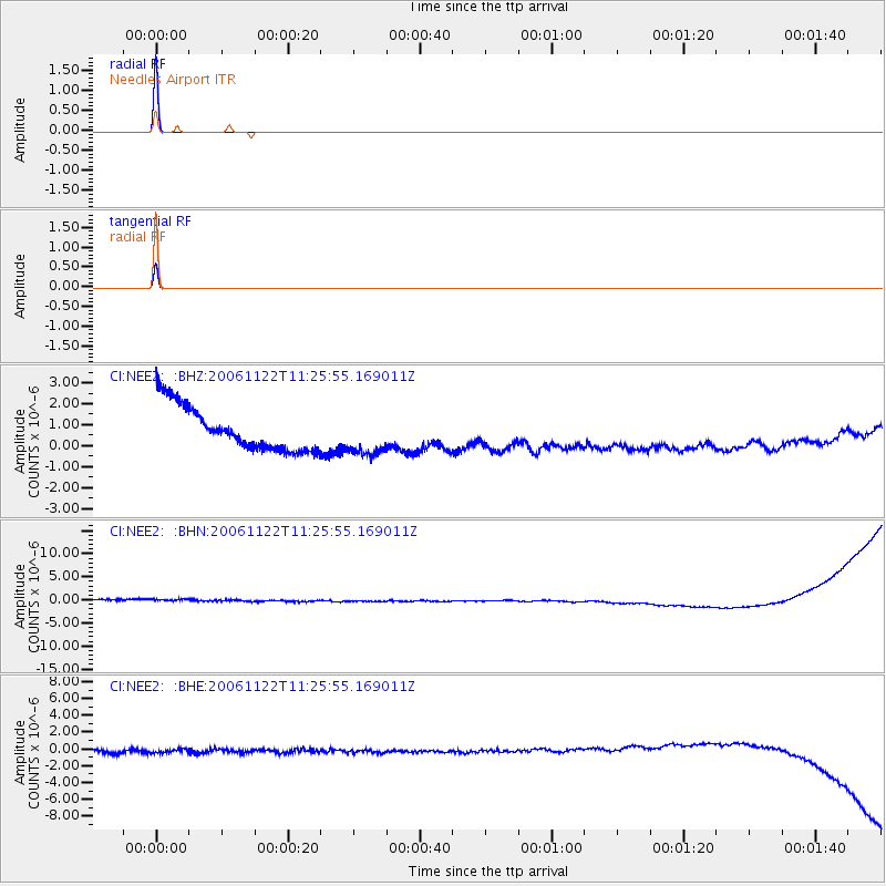
Signal To Noise
| Channel | StoN | STA | LTA |
| CI:NEE2: :BHN:20061122T11:25:55.169011Z | 0.9370531 | 1.2678884E-6 | 1.3530592E-6 |
| CI:NEE2: :BHE:20061122T11:25:55.169011Z | 0.7850404 | 6.5291147E-7 | 8.316916E-7 |
| CI:NEE2: :BHZ:20061122T11:25:55.169011Z | 0.9451609 | 9.985208E-7 | 1.0564559E-6 |
| Arrivals |
| Ps | 1.0 SECOND |
| PpPs | 4.0 SECOND |
| PsPs/PpSs | 5.0 SECOND |


