You are here: Home > Network List > CI - Caltech Regional Seismic Network Stations List
> Station LRL Laurel Mtn Radio Fac, Ridgecrest, CA, USA > Earthquake Result Viewer
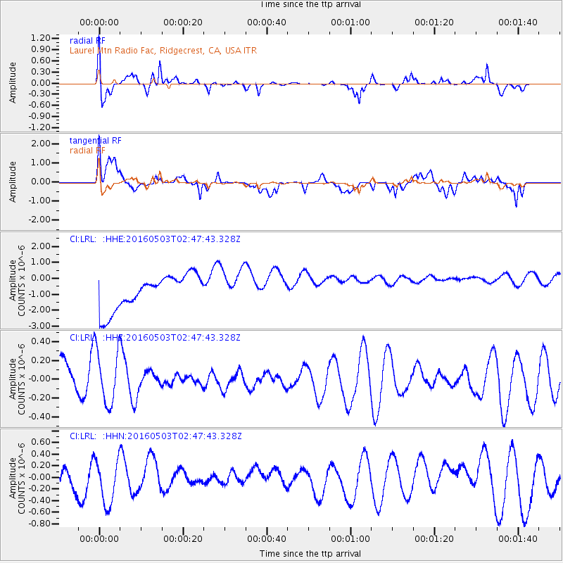
LRL Laurel Mtn Radio Fac, Ridgecrest, CA, USA - Earthquake Result Viewer
*The percent match for this event was below the threshold and hence no stack was calculated.
| Earthquake location: |
Pacific-Antarctic Ridge |
| Earthquake latitude/longitude: |
-55.8/-143.9 |
| Earthquake time(UTC): |
2016/05/03 (124) 02:34:58 GMT |
| Earthquake Depth: |
10 km |
| Earthquake Magnitude: |
5.5 mwb |
| Earthquake Catalog/Contributor: |
NEIC PDE/us |
|
| Network: |
CI Caltech Regional Seismic Network |
| Station: |
LRL Laurel Mtn Radio Fac, Ridgecrest, CA, USA |
| Lat/Lon: |
35.48 N/117.68 W |
| Elevation: |
1340 m |
|
| Distance: |
93.6 deg |
| Az: |
21.183 deg |
| Baz: |
194.491 deg |
| Ray Param: |
$rayparam |
*The percent match for this event was below the threshold and hence was not used in the summary stack. |
|
| Radial Match: |
75.724266 % |
| Radial Bump: |
400 |
| Transverse Match: |
33.743153 % |
| Transverse Bump: |
400 |
| SOD ConfigId: |
7422571 |
| Insert Time: |
2019-04-22 12:45:54.021 +0000 |
| GWidth: |
2.5 |
| Max Bumps: |
400 |
| Tol: |
0.001 |
|
Signal To Noise
| Channel | StoN | STA | LTA |
| CI:LRL: :HHZ:20160503T02:47:43.328Z | 1.2800243 | 2.8639676E-7 | 2.2374321E-7 |
| CI:LRL: :HHN:20160503T02:47:43.328Z | 1.4329948 | 4.1576604E-7 | 2.9013785E-7 |
| CI:LRL: :HHE:20160503T02:47:43.328Z | 1.0477278 | 1.1109396E-6 | 1.0603322E-6 |
| Arrivals |
| Ps | |
| PpPs | |
| PsPs/PpSs | |


