
SCIA State Center, Iowa, USA - Earthquake Result Viewer
| ||||||||||||||||||
| ||||||||||||||||||
| ||||||||||||||||||
|
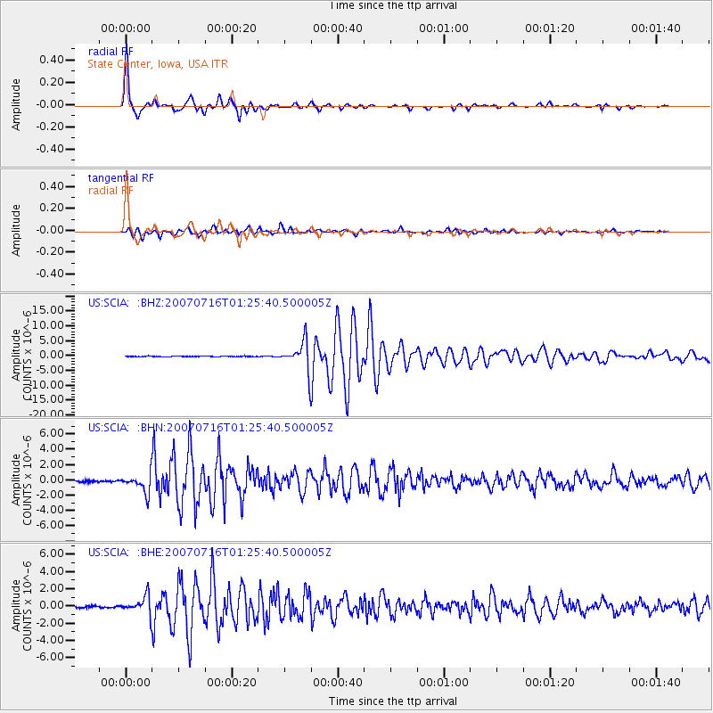
Signal To Noise
| Channel | StoN | STA | LTA |
| US:SCIA: :BHN:20070716T01:25:40.500005Z | 13.505306 | 1.2183941E-6 | 9.021596E-8 |
| US:SCIA: :BHE:20070716T01:25:40.500005Z | 12.866002 | 1.0538564E-6 | 8.1910166E-8 |
| US:SCIA: :BHZ:20070716T01:25:40.500005Z | 55.904415 | 4.9938308E-6 | 8.932802E-8 |
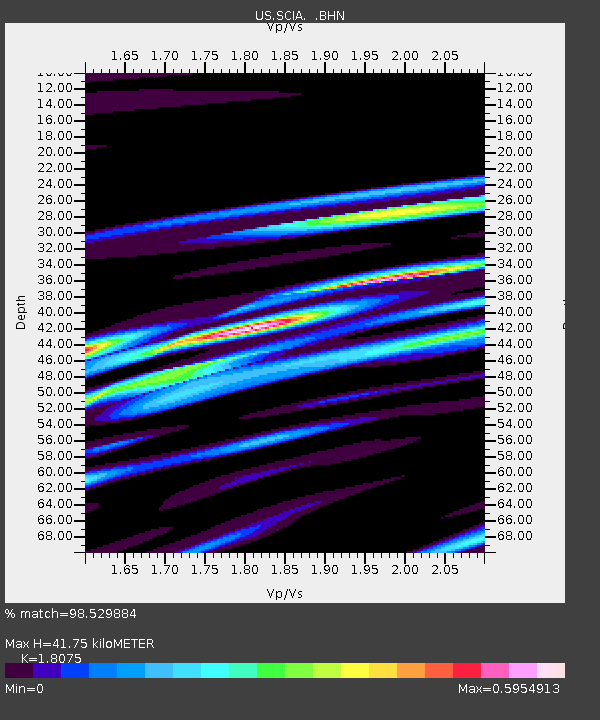
| Arrivals | |
| Ps | 5.3 SECOND |
| PpPs | 18 SECOND |
| PsPs/PpSs | 23 SECOND |

