You are here: Home > Network List > TA - USArray Transportable Network (new EarthScope stations) Stations List
> Station J20K Nowitna River, AK, USA > Earthquake Result Viewer
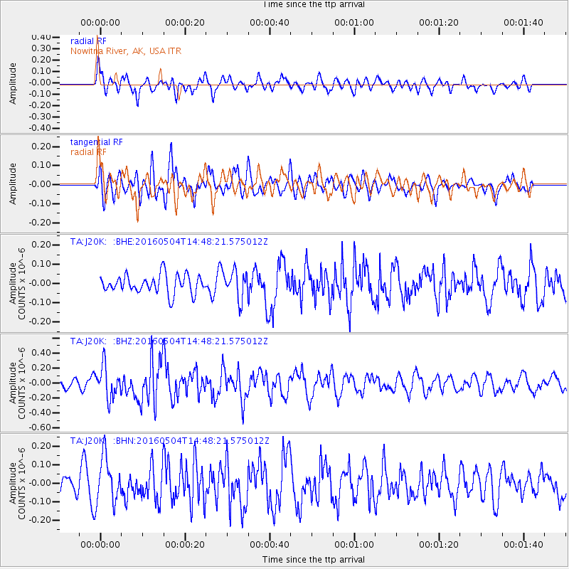
J20K Nowitna River, AK, USA - Earthquake Result Viewer
*The percent match for this event was below the threshold and hence no stack was calculated.
| Earthquake location: |
Vanuatu Islands |
| Earthquake latitude/longitude: |
-14.9/166.9 |
| Earthquake time(UTC): |
2016/05/04 (125) 14:36:25 GMT |
| Earthquake Depth: |
35 km |
| Earthquake Magnitude: |
5.7 MO |
| Earthquake Catalog/Contributor: |
NEIC PDE/NEIC ALERT |
|
| Network: |
TA USArray Transportable Network (new EarthScope stations) |
| Station: |
J20K Nowitna River, AK, USA |
| Lat/Lon: |
64.18 N/154.15 W |
| Elevation: |
314 m |
|
| Distance: |
84.3 deg |
| Az: |
16.064 deg |
| Baz: |
217.647 deg |
| Ray Param: |
$rayparam |
*The percent match for this event was below the threshold and hence was not used in the summary stack. |
|
| Radial Match: |
64.884224 % |
| Radial Bump: |
369 |
| Transverse Match: |
55.977673 % |
| Transverse Bump: |
400 |
| SOD ConfigId: |
7422571 |
| Insert Time: |
2019-04-22 12:52:54.209 +0000 |
| GWidth: |
2.5 |
| Max Bumps: |
400 |
| Tol: |
0.001 |
|
Signal To Noise
| Channel | StoN | STA | LTA |
| TA:J20K: :BHZ:20160504T14:48:21.575012Z | 2.567097 | 2.1650648E-7 | 8.4339035E-8 |
| TA:J20K: :BHN:20160504T14:48:21.575012Z | 1.8702476 | 1.2168155E-7 | 6.5061734E-8 |
| TA:J20K: :BHE:20160504T14:48:21.575012Z | 1.569553 | 7.461042E-8 | 4.7536094E-8 |
| Arrivals |
| Ps | |
| PpPs | |
| PsPs/PpSs | |


