
SCIA State Center, Iowa, USA - Earthquake Result Viewer
| ||||||||||||||||||
| ||||||||||||||||||
| ||||||||||||||||||
|
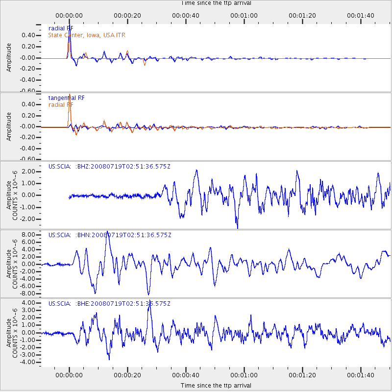
Signal To Noise
| Channel | StoN | STA | LTA |
| US:SCIA: :BHN:20080719T02:51:36.575Z | 11.551409 | 1.8367826E-6 | 1.590094E-7 |
| US:SCIA: :BHE:20080719T02:51:36.575Z | 8.622714 | 7.2697253E-7 | 8.4309015E-8 |
| US:SCIA: :BHZ:20080719T02:51:36.575Z | 5.3874726 | 4.352175E-7 | 8.078324E-8 |
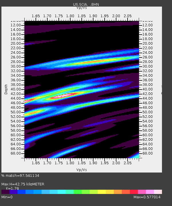
| Arrivals | |
| Ps | 5.1 SECOND |
| PpPs | 18 SECOND |
| PsPs/PpSs | 23 SECOND |

