You are here: Home > Network List > US - United States National Seismic Network Stations List
> Station SCIA State Center, Iowa, USA > Earthquake Result Viewer
SCIA State Center, Iowa, USA - Earthquake Result Viewer

| Earthquake location: |
Near Coast Of Venezuela |
| Earthquake latitude/longitude: |
10.7/-67.9 |
| Earthquake time(UTC): |
2009/09/12 (255) 20:06:24 GMT |
| Earthquake Depth: |
10 km |
| Earthquake Magnitude: |
6.3 MB, 6.4 MS, 6.3 MW, 6.3 MW |
| Earthquake Catalog/Contributor: |
WHDF/NEIC |
|
| Network: |
US United States National Seismic Network |
| Station: |
SCIA State Center, Iowa, USA |
| Lat/Lon: |
41.91 N/93.22 W |
| Elevation: |
312 m |
|
| Distance: |
38.2 deg |
| Az: |
328.935 deg |
| Baz: |
137.202 deg |
| Ray Param: |
0.07571228 |
| Estimated Moho Depth: |
37.0 km |
| Estimated Crust Vp/Vs: |
2.02 |
| Assumed Crust Vp: |
6.498 km/s |
| Estimated Crust Vs: |
3.225 km/s |
| Estimated Crust Poisson's Ratio: |
0.34 |
|
| Radial Match: |
94.0003 % |
| Radial Bump: |
389 |
| Transverse Match: |
89.83544 % |
| Transverse Bump: |
400 |
| SOD ConfigId: |
2622 |
| Insert Time: |
2010-03-05 02:51:06.864 +0000 |
| GWidth: |
2.5 |
| Max Bumps: |
400 |
| Tol: |
0.001 |
|
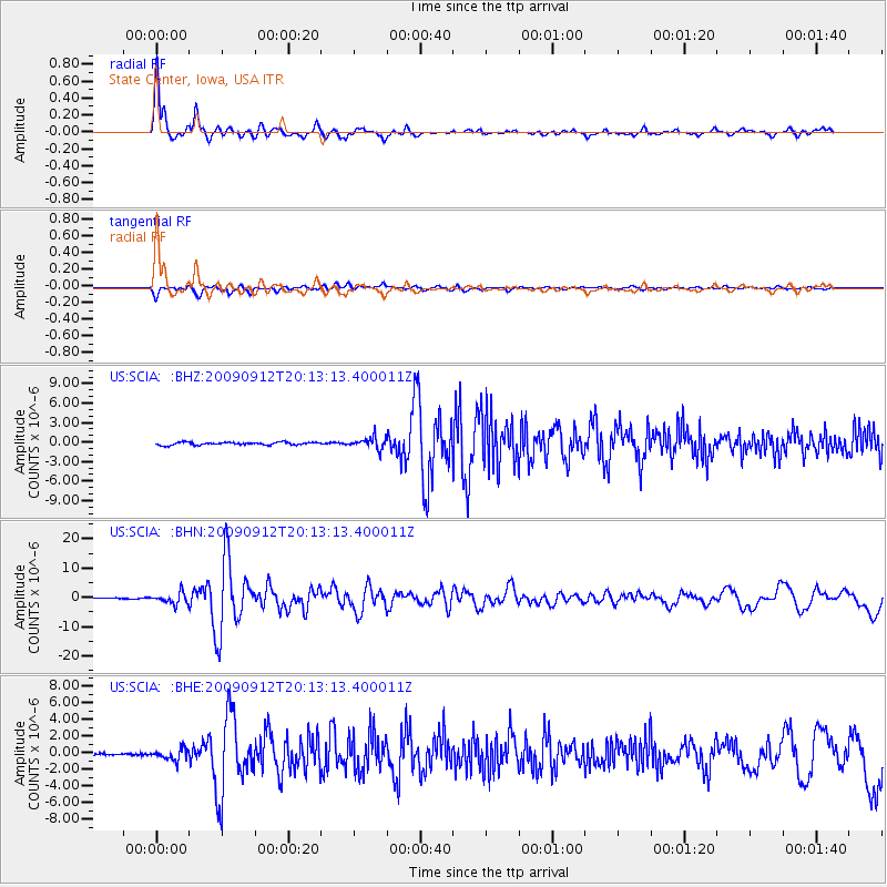
Signal To Noise
| Channel | StoN | STA | LTA |
| US:SCIA: :BHN:20090912T20:13:13.400011Z | 12.116538 | 1.8507287E-6 | 1.5274402E-7 |
| US:SCIA: :BHE:20090912T20:13:13.400011Z | 4.3265123 | 6.612686E-7 | 1.5284103E-7 |
| US:SCIA: :BHZ:20090912T20:13:13.400011Z | 4.139012 | 8.784031E-7 | 2.1222532E-7 |
| Arrivals |
| Ps | 6.2 SECOND |
| PpPs | 16 SECOND |
| PsPs/PpSs | 22 SECOND |


