SCIA State Center, Iowa, USA - Earthquake Result Viewer
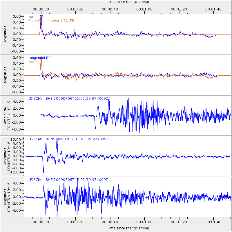
Earthquake location: Rat Islands, Aleutian Islands
Earthquake latitude/longitude: 50.4/177.0
Earthquake time(UTC): 2009/07/06 (187) 14:53:12 GMT
Earthquake Depth: 22 km
Earthquake Magnitude: 6.0 MB, 5.8 MS, 6.1 MW, 6.0 MW
Earthquake Catalog/Contributor: WHDF/NEIC
Network: US United States National Seismic Network
Station: SCIA State Center, Iowa, USA
Lat/Lon: 41.91 N/93.22 W
Elevation: 312 m
Distance: 59.1 deg
Az: 60.434 deg
Baz: 311.828 deg
Ray Param: 0.06237338
Estimated Moho Depth: 32.75 km
Estimated Crust Vp/Vs: 2.10
Assumed Crust Vp: 6.498 km/s
Estimated Crust Vs: 3.101 km/s
Estimated Crust Poisson's Ratio: 0.35
Radial Match: 92.041626 %
Radial Bump: 400
Transverse Match: 77.40794 %
Transverse Bump: 400
SOD ConfigId: 2648
Insert Time: 2010-03-05 02:51:33.673 +0000
GWidth: 2.5
Max Bumps: 400
Tol: 0.001

Signal To Noise

ChannelStoNSTALTA
US:SCIA: :BHN:20090706T15:02:39.974009Z23.8089734.342679E-61.8239673E-7
US:SCIA: :BHE:20090706T15:02:39.974009Z10.9350651.9076474E-61.7445231E-7
US:SCIA: :BHZ:20090706T15:02:39.974009Z8.07327651.5462201E-61.9152324E-7
Arrivals
Ps5.8 SECOND
PpPs15 SECOND
PsPs/PpSs21 SECOND