You are here: Home > Network List > WY - Yellowstone Wyoming Seismic Network Stations List
> Station YHH Holmes Hill, YNP, WY, USA > Earthquake Result Viewer
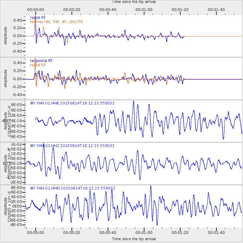
YHH Holmes Hill, YNP, WY, USA - Earthquake Result Viewer
*The percent match for this event was below the threshold and hence no stack was calculated.
| Earthquake location: |
Northern Mid-Atlantic Ridge |
| Earthquake latitude/longitude: |
21.1/-45.9 |
| Earthquake time(UTC): |
2015/08/14 (226) 18:03:03 GMT |
| Earthquake Depth: |
13 km |
| Earthquake Magnitude: |
5.5 MB |
| Earthquake Catalog/Contributor: |
NEIC PDE/NEIC COMCAT |
|
| Network: |
WY Yellowstone Wyoming Seismic Network |
| Station: |
YHH Holmes Hill, YNP, WY, USA |
| Lat/Lon: |
44.79 N/110.85 W |
| Elevation: |
2717 m |
|
| Distance: |
57.8 deg |
| Az: |
310.325 deg |
| Baz: |
91.512 deg |
| Ray Param: |
$rayparam |
*The percent match for this event was below the threshold and hence was not used in the summary stack. |
|
| Radial Match: |
68.71947 % |
| Radial Bump: |
357 |
| Transverse Match: |
72.48214 % |
| Transverse Bump: |
400 |
| SOD ConfigId: |
1085051 |
| Insert Time: |
2015-08-28 18:49:43.542 +0000 |
| GWidth: |
2.5 |
| Max Bumps: |
400 |
| Tol: |
0.001 |
|
Signal To Noise
| Channel | StoN | STA | LTA |
| WY:YHH:01:HHZ:20150814T18:12:23.55803Z | 6.5275097 | 7.835024E-9 | 1.2003083E-9 |
| WY:YHH:01:HHN:20150814T18:12:23.55803Z | 0.6074173 | 8.330247E-10 | 1.3714209E-9 |
| WY:YHH:01:HHE:20150814T18:12:23.55803Z | 2.4045553 | 2.9009712E-9 | 1.206448E-9 |
| Arrivals |
| Ps | |
| PpPs | |
| PsPs/PpSs | |


