You are here: Home > Network List > US - United States National Seismic Network Stations List
> Station SCIA State Center, Iowa, USA > Earthquake Result Viewer
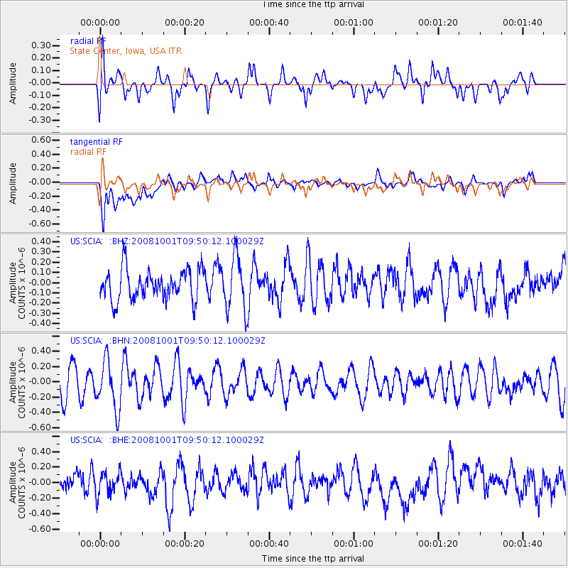
SCIA State Center, Iowa, USA - Earthquake Result Viewer
*The percent match for this event was below the threshold and hence no stack was calculated.
| Earthquake location: |
Southeast Of Honshu, Japan |
| Earthquake latitude/longitude: |
30.2/138.8 |
| Earthquake time(UTC): |
2008/10/01 (275) 09:38:12 GMT |
| Earthquake Depth: |
414 km |
| Earthquake Magnitude: |
5.7 MW, 5.1 MB, 5.7 MW |
| Earthquake Catalog/Contributor: |
WHDF/NEIC |
|
| Network: |
US United States National Seismic Network |
| Station: |
SCIA State Center, Iowa, USA |
| Lat/Lon: |
41.91 N/93.22 W |
| Elevation: |
312 m |
|
| Distance: |
93.7 deg |
| Az: |
36.117 deg |
| Baz: |
316.853 deg |
| Ray Param: |
$rayparam |
*The percent match for this event was below the threshold and hence was not used in the summary stack. |
|
| Radial Match: |
49.102386 % |
| Radial Bump: |
400 |
| Transverse Match: |
54.258442 % |
| Transverse Bump: |
400 |
| SOD ConfigId: |
2556 |
| Insert Time: |
2010-03-05 02:55:19.119 +0000 |
| GWidth: |
2.5 |
| Max Bumps: |
400 |
| Tol: |
0.001 |
|
Signal To Noise
| Channel | StoN | STA | LTA |
| US:SCIA: :BHN:20081001T09:50:12.100029Z | 2.2111406 | 3.3217265E-7 | 1.5022684E-7 |
| US:SCIA: :BHE:20081001T09:50:12.100029Z | 1.1617484 | 1.4974916E-7 | 1.2889981E-7 |
| US:SCIA: :BHZ:20081001T09:50:12.100029Z | 1.8087721 | 2.6471926E-7 | 1.4635302E-7 |
| Arrivals |
| Ps | |
| PpPs | |
| PsPs/PpSs | |


