NEE2 Needles Airport - Earthquake Result Viewer
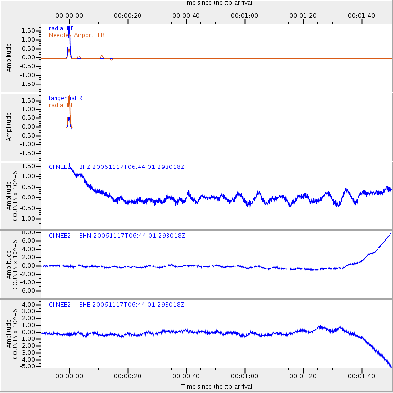
Earthquake location: East Of Kuril Islands
Earthquake latitude/longitude: 47.0/155.5
Earthquake time(UTC): 2006/11/17 (321) 06:33:49 GMT
Earthquake Depth: 10 km
Earthquake Magnitude: 5.4 MB, 5.0 MS, 5.6 MW, 5.5 MW
Earthquake Catalog/Contributor: WHDF/NEIC
Network: CI Caltech Regional Seismic Network
Station: NEE2 Needles Airport
Lat/Lon: 34.77 N/114.62 W
Elevation: 271 m
Distance: 65.5 deg
Az: 64.829 deg
Baz: 311.219 deg
Ray Param: 0.058260504
Estimated Moho Depth: 10.0 km
Estimated Crust Vp/Vs: 1.60
Assumed Crust Vp: 6.276 km/s
Estimated Crust Vs: 3.922 km/s
Estimated Crust Poisson's Ratio: 0.18
Radial Match: 99.96464 %
Radial Bump: 2
Transverse Match: 99.80277 %
Transverse Bump: 16
SOD ConfigId: 2564
Insert Time: 2010-02-26 00:20:48.485 +0000
GWidth: 2.5
Max Bumps: 400
Tol: 0.001

Signal To Noise

ChannelStoNSTALTA
CI:NEE2: :BHN:20061117T06:44:01.293018Z0.8832125.915704E-76.697944E-7
CI:NEE2: :BHE:20061117T06:44:01.293018Z1.0751754.8568995E-74.517311E-7
CI:NEE2: :BHZ:20061117T06:44:01.293018Z0.88148624.4726193E-75.0739527E-7
Arrivals
Ps1.0 SECOND
PpPs4.0 SECOND
PsPs/PpSs5.0 SECOND