You are here: Home > Network List > TA - USArray Transportable Network (new EarthScope stations) Stations List
> Station I23K Minto, Yukon-Koyukuk, AK, USA > Earthquake Result Viewer
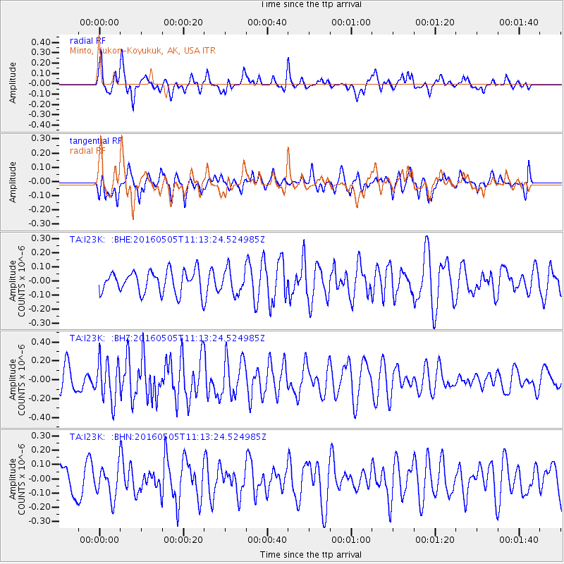
I23K Minto, Yukon-Koyukuk, AK, USA - Earthquake Result Viewer
*The percent match for this event was below the threshold and hence no stack was calculated.
| Earthquake location: |
Central East Pacific Rise |
| Earthquake latitude/longitude: |
-8.9/-108.2 |
| Earthquake time(UTC): |
2016/05/05 (126) 11:01:46 GMT |
| Earthquake Depth: |
10 km |
| Earthquake Magnitude: |
5.6 mwb |
| Earthquake Catalog/Contributor: |
NEIC PDE/us |
|
| Network: |
TA USArray Transportable Network (new EarthScope stations) |
| Station: |
I23K Minto, Yukon-Koyukuk, AK, USA |
| Lat/Lon: |
65.15 N/149.36 W |
| Elevation: |
149 m |
|
| Distance: |
79.9 deg |
| Az: |
343.605 deg |
| Baz: |
138.708 deg |
| Ray Param: |
$rayparam |
*The percent match for this event was below the threshold and hence was not used in the summary stack. |
|
| Radial Match: |
64.618645 % |
| Radial Bump: |
400 |
| Transverse Match: |
41.371323 % |
| Transverse Bump: |
400 |
| SOD ConfigId: |
7422571 |
| Insert Time: |
2019-04-22 13:05:24.526 +0000 |
| GWidth: |
2.5 |
| Max Bumps: |
400 |
| Tol: |
0.001 |
|
Signal To Noise
| Channel | StoN | STA | LTA |
| TA:I23K: :BHZ:20160505T11:13:24.524985Z | 2.0272 | 2.1729053E-7 | 1.0718752E-7 |
| TA:I23K: :BHN:20160505T11:13:24.524985Z | 1.0883137 | 1.1254129E-7 | 1.03408865E-7 |
| TA:I23K: :BHE:20160505T11:13:24.524985Z | 1.1105125 | 8.630215E-8 | 7.771381E-8 |
| Arrivals |
| Ps | |
| PpPs | |
| PsPs/PpSs | |


