You are here: Home > Network List > UW - Pacific Northwest Regional Seismic Network Stations List
> Station MRBL Marblemount, WA, USA > Earthquake Result Viewer
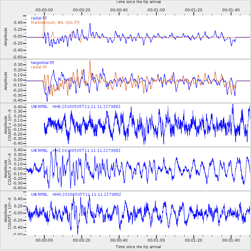
MRBL Marblemount, WA, USA - Earthquake Result Viewer
*The percent match for this event was below the threshold and hence no stack was calculated.
| Earthquake location: |
Central East Pacific Rise |
| Earthquake latitude/longitude: |
-8.9/-108.2 |
| Earthquake time(UTC): |
2016/05/05 (126) 11:01:46 GMT |
| Earthquake Depth: |
10 km |
| Earthquake Magnitude: |
5.6 mwb |
| Earthquake Catalog/Contributor: |
NEIC PDE/us |
|
| Network: |
UW Pacific Northwest Regional Seismic Network |
| Station: |
MRBL Marblemount, WA, USA |
| Lat/Lon: |
48.52 N/121.48 W |
| Elevation: |
75 m |
|
| Distance: |
58.4 deg |
| Az: |
349.696 deg |
| Baz: |
164.585 deg |
| Ray Param: |
$rayparam |
*The percent match for this event was below the threshold and hence was not used in the summary stack. |
|
| Radial Match: |
44.226994 % |
| Radial Bump: |
400 |
| Transverse Match: |
62.052433 % |
| Transverse Bump: |
400 |
| SOD ConfigId: |
7422571 |
| Insert Time: |
2019-04-22 13:06:27.362 +0000 |
| GWidth: |
2.5 |
| Max Bumps: |
400 |
| Tol: |
0.001 |
|
Signal To Noise
| Channel | StoN | STA | LTA |
| UW:MRBL: :HHZ:20160505T11:11:11.227988Z | 3.6970766 | 2.0562513E-7 | 5.5618305E-8 |
| UW:MRBL: :HHN:20160505T11:11:11.227988Z | 1.6733198 | 1.4548974E-7 | 8.694676E-8 |
| UW:MRBL: :HHE:20160505T11:11:11.227988Z | 1.0887781 | 1.2809507E-7 | 1.17650295E-7 |
| Arrivals |
| Ps | |
| PpPs | |
| PsPs/PpSs | |


