You are here: Home > Network List > CI - Caltech Regional Seismic Network Stations List
> Station NEE2 Needles Airport > Earthquake Result Viewer
NEE2 Needles Airport - Earthquake Result Viewer
| Earthquake location: |
Kuril Islands |
| Earthquake latitude/longitude: |
46.7/153.3 |
| Earthquake time(UTC): |
2006/11/15 (319) 21:40:08 GMT |
| Earthquake Depth: |
10 km |
| Earthquake Magnitude: |
5.5 MB |
| Earthquake Catalog/Contributor: |
WHDF/NEIC |
|
| Network: |
CI Caltech Regional Seismic Network |
| Station: |
NEE2 Needles Airport |
| Lat/Lon: |
34.77 N/114.62 W |
| Elevation: |
271 m |
|
| Distance: |
67.0 deg |
| Az: |
63.385 deg |
| Baz: |
311.654 deg |
| Ray Param: |
0.05726925 |
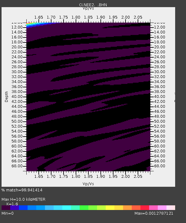
| Estimated Moho Depth: |
10.0 km |
| Estimated Crust Vp/Vs: |
1.60 |
| Assumed Crust Vp: |
6.276 km/s |
| Estimated Crust Vs: |
3.922 km/s |
| Estimated Crust Poisson's Ratio: |
0.18 |
|
| Radial Match: |
99.941414 % |
| Radial Bump: |
7 |
| Transverse Match: |
99.34652 % |
| Transverse Bump: |
28 |
| SOD ConfigId: |
2564 |
| Insert Time: |
2010-02-26 00:20:50.596 +0000 |
| GWidth: |
2.5 |
| Max Bumps: |
400 |
| Tol: |
0.001 |
|
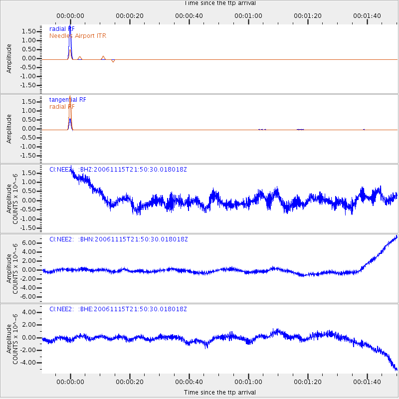
Signal To Noise
| Channel | StoN | STA | LTA |
| CI:NEE2: :BHN:20061115T21:50:30.018018Z | 1.2166361 | 8.3199967E-7 | 6.8385253E-7 |
| CI:NEE2: :BHE:20061115T21:50:30.018018Z | 0.77269644 | 3.3839117E-7 | 4.3793546E-7 |
| CI:NEE2: :BHZ:20061115T21:50:30.018018Z | 0.8286687 | 5.333069E-7 | 6.4357073E-7 |
| Arrivals |
| Ps | 1.0 SECOND |
| PpPs | 4.0 SECOND |
| PsPs/PpSs | 5.0 SECOND |


