You are here: Home > Network List > US - United States National Seismic Network Stations List
> Station BRAL Brewton, Alabama, USA > Earthquake Result Viewer
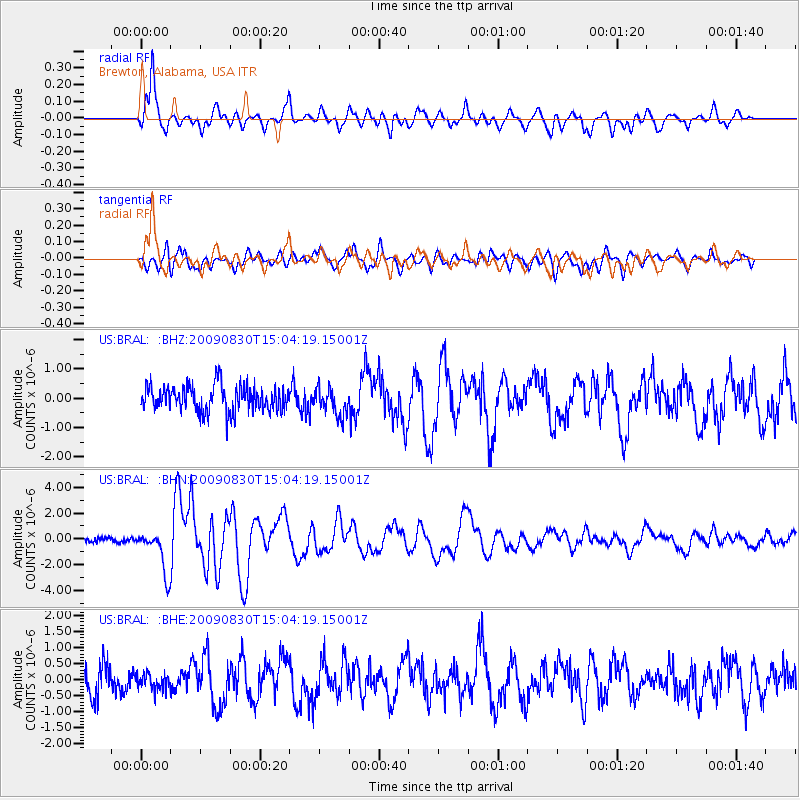
BRAL Brewton, Alabama, USA - Earthquake Result Viewer
*The percent match for this event was below the threshold and hence no stack was calculated.
| Earthquake location: |
Samoa Islands Region |
| Earthquake latitude/longitude: |
-15.2/-172.6 |
| Earthquake time(UTC): |
2009/08/30 (242) 14:51:32 GMT |
| Earthquake Depth: |
11 km |
| Earthquake Magnitude: |
6.4 MB, 6.3 MS, 6.6 MW, 6.6 MW |
| Earthquake Catalog/Contributor: |
WHDF/NEIC |
|
| Network: |
US United States National Seismic Network |
| Station: |
BRAL Brewton, Alabama, USA |
| Lat/Lon: |
31.01 N/87.06 W |
| Elevation: |
61 m |
|
| Distance: |
94.0 deg |
| Az: |
59.093 deg |
| Baz: |
254.73 deg |
| Ray Param: |
$rayparam |
*The percent match for this event was below the threshold and hence was not used in the summary stack. |
|
| Radial Match: |
82.41415 % |
| Radial Bump: |
400 |
| Transverse Match: |
77.58809 % |
| Transverse Bump: |
400 |
| SOD ConfigId: |
2622 |
| Insert Time: |
2010-03-05 02:57:56.753 +0000 |
| GWidth: |
2.5 |
| Max Bumps: |
400 |
| Tol: |
0.001 |
|
Signal To Noise
| Channel | StoN | STA | LTA |
| US:BRAL: :BHN:20090830T15:04:19.15001Z | 8.443303 | 1.6564744E-6 | 1.9618795E-7 |
| US:BRAL: :BHE:20090830T15:04:19.15001Z | 0.52021635 | 2.4620203E-7 | 4.7326853E-7 |
| US:BRAL: :BHZ:20090830T15:04:19.15001Z | 1.0662557 | 4.6478903E-7 | 4.3590768E-7 |
| Arrivals |
| Ps | |
| PpPs | |
| PsPs/PpSs | |


