You are here: Home > Network List > US - United States National Seismic Network Stations List
> Station BRAL Brewton, Alabama, USA > Earthquake Result Viewer
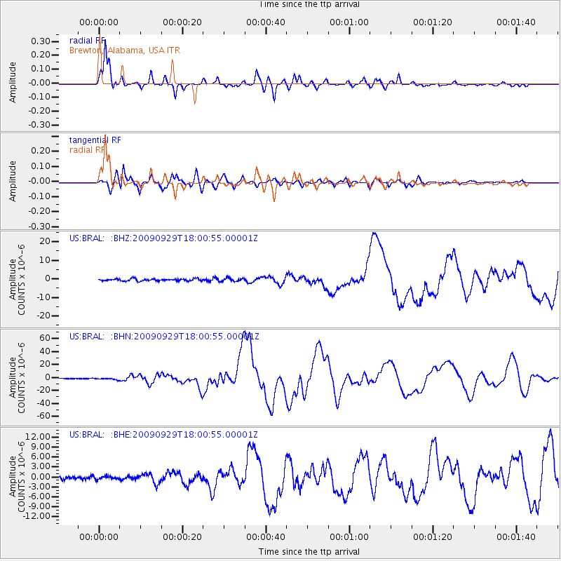
BRAL Brewton, Alabama, USA - Earthquake Result Viewer
*The percent match for this event was below the threshold and hence no stack was calculated.
| Earthquake location: |
Samoa Islands Region |
| Earthquake latitude/longitude: |
-15.5/-172.1 |
| Earthquake time(UTC): |
2009/09/29 (272) 17:48:10 GMT |
| Earthquake Depth: |
18 km |
| Earthquake Magnitude: |
7.1 MB, 8.1 MS, 8.1 MW, 8.0 MW |
| Earthquake Catalog/Contributor: |
WHDF/NEIC |
|
| Network: |
US United States National Seismic Network |
| Station: |
BRAL Brewton, Alabama, USA |
| Lat/Lon: |
31.01 N/87.06 W |
| Elevation: |
61 m |
|
| Distance: |
93.7 deg |
| Az: |
58.998 deg |
| Baz: |
254.266 deg |
| Ray Param: |
$rayparam |
*The percent match for this event was below the threshold and hence was not used in the summary stack. |
|
| Radial Match: |
97.493286 % |
| Radial Bump: |
400 |
| Transverse Match: |
93.52732 % |
| Transverse Bump: |
400 |
| SOD ConfigId: |
2622 |
| Insert Time: |
2010-03-05 02:58:01.837 +0000 |
| GWidth: |
2.5 |
| Max Bumps: |
400 |
| Tol: |
0.001 |
|
Signal To Noise
| Channel | StoN | STA | LTA |
| US:BRAL: :BHN:20090929T18:00:55.00001Z | 3.279226 | 1.2088279E-6 | 3.6863207E-7 |
| US:BRAL: :BHE:20090929T18:00:55.00001Z | 0.9781879 | 4.0968868E-7 | 4.1882407E-7 |
| US:BRAL: :BHZ:20090929T18:00:55.00001Z | 1.5348711 | 8.699028E-7 | 5.667595E-7 |
| Arrivals |
| Ps | |
| PpPs | |
| PsPs/PpSs | |


