You are here: Home > Network List > TA - USArray Transportable Network (new EarthScope stations) Stations List
> Station J01E Myrtle Point, OR, USA > Earthquake Result Viewer
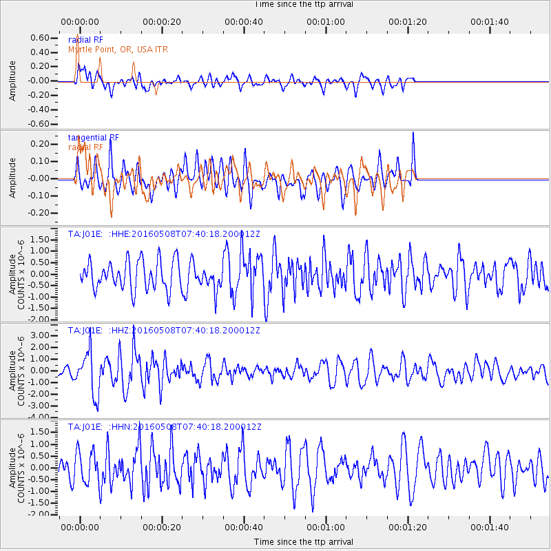
J01E Myrtle Point, OR, USA - Earthquake Result Viewer
*The percent match for this event was below the threshold and hence no stack was calculated.
| Earthquake location: |
Oaxaca, Mexico |
| Earthquake latitude/longitude: |
16.6/-97.7 |
| Earthquake time(UTC): |
2016/05/08 (129) 07:34:02 GMT |
| Earthquake Depth: |
24 km |
| Earthquake Magnitude: |
5.9 MB |
| Earthquake Catalog/Contributor: |
NEIC PDE/NEIC ALERT |
|
| Network: |
TA USArray Transportable Network (new EarthScope stations) |
| Station: |
J01E Myrtle Point, OR, USA |
| Lat/Lon: |
43.16 N/123.93 W |
| Elevation: |
128 m |
|
| Distance: |
34.7 deg |
| Az: |
325.327 deg |
| Baz: |
131.79 deg |
| Ray Param: |
$rayparam |
*The percent match for this event was below the threshold and hence was not used in the summary stack. |
|
| Radial Match: |
54.817436 % |
| Radial Bump: |
400 |
| Transverse Match: |
61.910606 % |
| Transverse Bump: |
400 |
| SOD ConfigId: |
7422571 |
| Insert Time: |
2019-04-22 13:25:25.965 +0000 |
| GWidth: |
2.5 |
| Max Bumps: |
400 |
| Tol: |
0.001 |
|
Signal To Noise
| Channel | StoN | STA | LTA |
| TA:J01E: :HHZ:20160508T07:40:18.200012Z | 2.822876 | 1.8838181E-6 | 6.6734003E-7 |
| TA:J01E: :HHN:20160508T07:40:18.200012Z | 1.2335893 | 6.959708E-7 | 5.6418355E-7 |
| TA:J01E: :HHE:20160508T07:40:18.200012Z | 0.94092894 | 5.999851E-7 | 6.376519E-7 |
| Arrivals |
| Ps | |
| PpPs | |
| PsPs/PpSs | |


