You are here: Home > Network List > UW - Pacific Northwest Regional Seismic Network Stations List
> Station LEBA Lebam, WA, USA > Earthquake Result Viewer
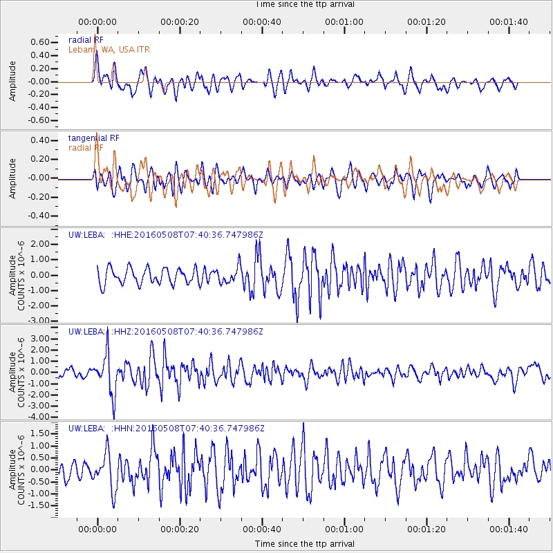
LEBA Lebam, WA, USA - Earthquake Result Viewer
*The percent match for this event was below the threshold and hence no stack was calculated.
| Earthquake location: |
Oaxaca, Mexico |
| Earthquake latitude/longitude: |
16.6/-97.7 |
| Earthquake time(UTC): |
2016/05/08 (129) 07:34:02 GMT |
| Earthquake Depth: |
24 km |
| Earthquake Magnitude: |
5.9 MB |
| Earthquake Catalog/Contributor: |
NEIC PDE/NEIC ALERT |
|
| Network: |
UW Pacific Northwest Regional Seismic Network |
| Station: |
LEBA Lebam, WA, USA |
| Lat/Lon: |
46.55 N/123.56 W |
| Elevation: |
73 m |
|
| Distance: |
36.8 deg |
| Az: |
329.824 deg |
| Baz: |
135.701 deg |
| Ray Param: |
$rayparam |
*The percent match for this event was below the threshold and hence was not used in the summary stack. |
|
| Radial Match: |
68.08243 % |
| Radial Bump: |
400 |
| Transverse Match: |
53.827293 % |
| Transverse Bump: |
400 |
| SOD ConfigId: |
7422571 |
| Insert Time: |
2019-04-22 13:26:16.680 +0000 |
| GWidth: |
2.5 |
| Max Bumps: |
400 |
| Tol: |
0.001 |
|
Signal To Noise
| Channel | StoN | STA | LTA |
| UW:LEBA: :HHZ:20160508T07:40:36.747986Z | 5.8135514 | 1.8107613E-6 | 3.1147246E-7 |
| UW:LEBA: :HHN:20160508T07:40:36.747986Z | 2.4134164 | 7.896931E-7 | 3.2720962E-7 |
| UW:LEBA: :HHE:20160508T07:40:36.747986Z | 1.0653688 | 5.3915716E-7 | 5.0607565E-7 |
| Arrivals |
| Ps | |
| PpPs | |
| PsPs/PpSs | |


