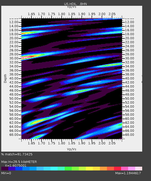
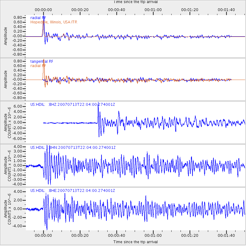
HDIL Hopedale, Illinois, USA - Earthquake Result Viewer

Earthquake location: Andreanof Islands, Aleutian Is.
Earthquake latitude/longitude: 51.8/-176.3
Earthquake time(UTC): 2007/07/13 (194) 21:54:43 GMT
Earthquake Depth: 35 km
Earthquake Magnitude: 5.7 MB, 5.6 MS, 6.0 MW, 5.9 MW
Earthquake Catalog/Contributor: WHDF/NEIC
Network: US United States National Seismic Network
Station: HDIL Hopedale, Illinois, USA
Lat/Lon: 40.56 N/89.29 W
Elevation: 219 m
Distance: 57.8 deg
Az: 64.041 deg
Baz: 312.932 deg
Ray Param: 0.06319319
Estimated Moho Depth: 29.5 km
Estimated Crust Vp/Vs: 1.61
Assumed Crust Vp: 6.498 km/s
Estimated Crust Vs: 4.042 km/s
Estimated Crust Poisson's Ratio: 0.18
Radial Match: 91.73425 %
Radial Bump: 400
Transverse Match: 81.89534 %
Transverse Bump: 400
SOD ConfigId: 2564
Insert Time: 2010-03-05 02:58:51.223 +0000
GWidth: 2.5
Max Bumps: 400
Tol: 0.001

Signal To Noise

ChannelStoNSTALTA
US:HDIL: :BHN:20070713T22:04:00.274001Z20.226042.2613958E-61.11806166E-7
US:HDIL: :BHE:20070713T22:04:00.274001Z14.4879962.0017098E-61.3816333E-7
US:HDIL: :BHZ:20070713T22:04:00.274001Z34.600442.6401244E-67.6303195E-8
Arrivals
Ps2.9 SECOND
PpPs11 SECOND
PsPs/PpSs14 SECOND