HDIL Hopedale, Illinois, USA - Earthquake Result Viewer
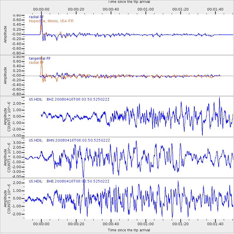
Earthquake location: Andreanof Islands, Aleutian Is.
Earthquake latitude/longitude: 51.9/-179.2
Earthquake time(UTC): 2008/04/16 (107) 05:54:19 GMT
Earthquake Depth: 13 km
Earthquake Magnitude: 6.1 MB, 6.5 MS, 6.6 MW, 6.6 MW
Earthquake Catalog/Contributor: WHDF/NEIC
Network: US United States National Seismic Network
Station: HDIL Hopedale, Illinois, USA
Lat/Lon: 40.56 N/89.29 W
Elevation: 219 m
Distance: 59.4 deg
Az: 62.292 deg
Baz: 313.92 deg
Ray Param: 0.0622169
Estimated Moho Depth: 28.25 km
Estimated Crust Vp/Vs: 1.66
Assumed Crust Vp: 6.498 km/s
Estimated Crust Vs: 3.92 km/s
Estimated Crust Poisson's Ratio: 0.21
Radial Match: 88.24911 %
Radial Bump: 400
Transverse Match: 70.62707 %
Transverse Bump: 400
SOD ConfigId: 2504
Insert Time: 2010-03-05 02:59:01.682 +0000
GWidth: 2.5
Max Bumps: 400
Tol: 0.001

Signal To Noise

ChannelStoNSTALTA
US:HDIL: :BHN:20080416T06:03:50.525022Z2.38156445.6262974E-72.3624375E-7
US:HDIL: :BHE:20080416T06:03:50.525022Z1.22473113.087192E-72.52071E-7
US:HDIL: :BHZ:20080416T06:03:50.525022Z1.44828624.4980936E-73.1058048E-7
Arrivals
Ps3.0 SECOND
PpPs11 SECOND
PsPs/PpSs14 SECOND