HDIL Hopedale, Illinois, USA - Earthquake Result Viewer
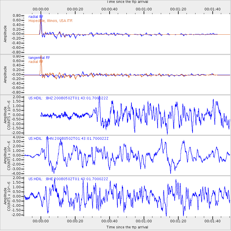
Earthquake location: Andreanof Islands, Aleutian Is.
Earthquake latitude/longitude: 51.9/-177.5
Earthquake time(UTC): 2008/05/02 (123) 01:33:37 GMT
Earthquake Depth: 14 km
Earthquake Magnitude: 6.3 MB, 6.8 MS, 6.6 MW, 6.6 MW
Earthquake Catalog/Contributor: WHDF/NEIC
Network: US United States National Seismic Network
Station: HDIL Hopedale, Illinois, USA
Lat/Lon: 40.56 N/89.29 W
Elevation: 219 m
Distance: 58.5 deg
Az: 63.29 deg
Baz: 313.364 deg
Ray Param: 0.06280246
Estimated Moho Depth: 28.5 km
Estimated Crust Vp/Vs: 1.65
Assumed Crust Vp: 6.498 km/s
Estimated Crust Vs: 3.932 km/s
Estimated Crust Poisson's Ratio: 0.21
Radial Match: 94.23312 %
Radial Bump: 400
Transverse Match: 68.57315 %
Transverse Bump: 400
SOD ConfigId: 2504
Insert Time: 2010-03-05 02:59:05.180 +0000
GWidth: 2.5
Max Bumps: 400
Tol: 0.001

Signal To Noise

ChannelStoNSTALTA
US:HDIL: :BHN:20080502T01:43:01.700022Z14.5387871.7626029E-61.2123452E-7
US:HDIL: :BHE:20080502T01:43:01.700022Z3.3193598.1788505E-72.4639849E-7
US:HDIL: :BHZ:20080502T01:43:01.700022Z4.81590757.72784E-71.6046486E-7
Arrivals
Ps3.0 SECOND
PpPs11 SECOND
PsPs/PpSs14 SECOND