HDIL Hopedale, Illinois, USA - Earthquake Result Viewer
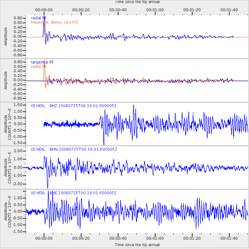
Earthquake location: Rat Islands, Aleutian Islands
Earthquake latitude/longitude: 51.3/179.0
Earthquake time(UTC): 2008/07/25 (207) 00:29:22 GMT
Earthquake Depth: 21 km
Earthquake Magnitude: 5.7 MB, 5.5 MS, 5.9 MW, 5.9 MW
Earthquake Catalog/Contributor: WHDF/NEIC
Network: US United States National Seismic Network
Station: HDIL Hopedale, Illinois, USA
Lat/Lon: 40.56 N/89.29 W
Elevation: 219 m
Distance: 60.7 deg
Az: 60.858 deg
Baz: 313.946 deg
Ray Param: 0.061342537
Estimated Moho Depth: 29.0 km
Estimated Crust Vp/Vs: 1.64
Assumed Crust Vp: 6.498 km/s
Estimated Crust Vs: 3.962 km/s
Estimated Crust Poisson's Ratio: 0.20
Radial Match: 90.28243 %
Radial Bump: 400
Transverse Match: 73.44742 %
Transverse Bump: 400
SOD ConfigId: 2504
Insert Time: 2010-03-05 02:59:21.405 +0000
GWidth: 2.5
Max Bumps: 400
Tol: 0.001

Signal To Noise

ChannelStoNSTALTA
US:HDIL: :BHN:20080725T00:39:01.600005Z10.464839.1231504E-78.717915E-8
US:HDIL: :BHE:20080725T00:39:01.600005Z4.4394266.62693E-71.492745E-7
US:HDIL: :BHZ:20080725T00:39:01.600005Z5.37570525.92644E-71.102449E-7
Arrivals
Ps3.0 SECOND
PpPs11 SECOND
PsPs/PpSs14 SECOND