You are here: Home > Network List > US - United States National Seismic Network Stations List
> Station HDIL Hopedale, Illinois, USA > Earthquake Result Viewer
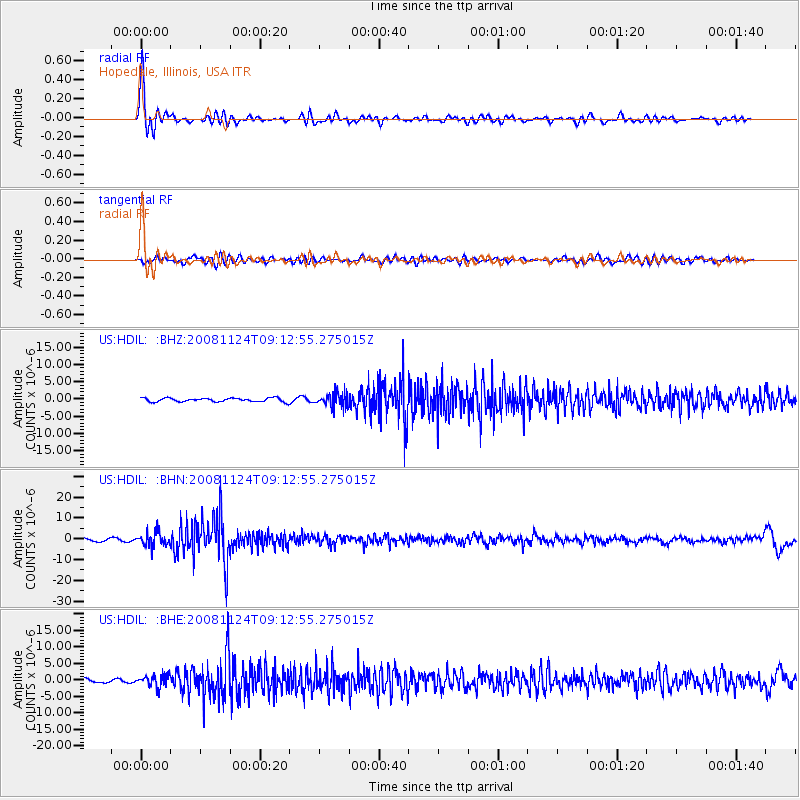
HDIL Hopedale, Illinois, USA - Earthquake Result Viewer

| Earthquake location: |
Sea Of Okhotsk |
| Earthquake latitude/longitude: |
54.2/154.3 |
| Earthquake time(UTC): |
2008/11/24 (329) 09:02:58 GMT |
| Earthquake Depth: |
492 km |
| Earthquake Magnitude: |
6.5 MB, 7.3 MW, 7.3 MW |
| Earthquake Catalog/Contributor: |
WHDF/NEIC |
|
| Network: |
US United States National Seismic Network |
| Station: |
HDIL Hopedale, Illinois, USA |
| Lat/Lon: |
40.56 N/89.29 W |
| Elevation: |
219 m |
|
| Distance: |
71.0 deg |
| Az: |
46.202 deg |
| Baz: |
326.182 deg |
| Ray Param: |
0.053000886 |
| Estimated Moho Depth: |
29.0 km |
| Estimated Crust Vp/Vs: |
1.96 |
| Assumed Crust Vp: |
6.498 km/s |
| Estimated Crust Vs: |
3.319 km/s |
| Estimated Crust Poisson's Ratio: |
0.32 |
|
| Radial Match: |
88.40971 % |
| Radial Bump: |
400 |
| Transverse Match: |
57.83338 % |
| Transverse Bump: |
400 |
| SOD ConfigId: |
2658 |
| Insert Time: |
2010-03-05 02:59:35.544 +0000 |
| GWidth: |
2.5 |
| Max Bumps: |
400 |
| Tol: |
0.001 |
|
Signal To Noise
| Channel | StoN | STA | LTA |
| US:HDIL: :BHN:20081124T09:12:55.275015Z | 6.5273657 | 3.2592952E-6 | 4.993278E-7 |
| US:HDIL: :BHE:20081124T09:12:55.275015Z | 2.6430275 | 1.7546756E-6 | 6.638885E-7 |
| US:HDIL: :BHZ:20081124T09:12:55.275015Z | 3.652332 | 1.9459076E-6 | 5.3278495E-7 |
| Arrivals |
| Ps | 4.4 SECOND |
| PpPs | 13 SECOND |
| PsPs/PpSs | 17 SECOND |


