You are here: Home > Network List > US - United States National Seismic Network Stations List
> Station HDIL Hopedale, Illinois, USA > Earthquake Result Viewer
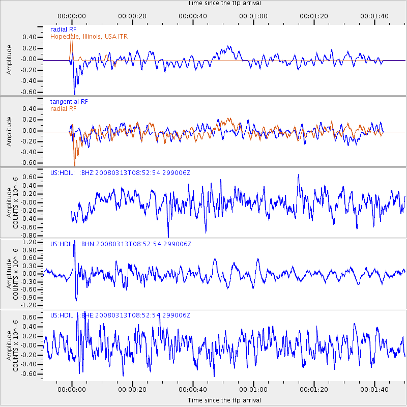
HDIL Hopedale, Illinois, USA - Earthquake Result Viewer
*The percent match for this event was below the threshold and hence no stack was calculated.
| Earthquake location: |
Kuril Islands |
| Earthquake latitude/longitude: |
43.1/146.5 |
| Earthquake time(UTC): |
2008/03/13 (073) 08:41:07 GMT |
| Earthquake Depth: |
53 km |
| Earthquake Magnitude: |
5.6 MB, 5.4 MW, 5.3 MW |
| Earthquake Catalog/Contributor: |
WHDF/NEIC |
|
| Network: |
US United States National Seismic Network |
| Station: |
HDIL Hopedale, Illinois, USA |
| Lat/Lon: |
40.56 N/89.29 W |
| Elevation: |
219 m |
|
| Distance: |
82.7 deg |
| Az: |
39.456 deg |
| Baz: |
322.321 deg |
| Ray Param: |
$rayparam |
*The percent match for this event was below the threshold and hence was not used in the summary stack. |
|
| Radial Match: |
44.52344 % |
| Radial Bump: |
400 |
| Transverse Match: |
52.257835 % |
| Transverse Bump: |
400 |
| SOD ConfigId: |
2504 |
| Insert Time: |
2010-03-05 02:59:59.663 +0000 |
| GWidth: |
2.5 |
| Max Bumps: |
400 |
| Tol: |
0.001 |
|
Signal To Noise
| Channel | StoN | STA | LTA |
| US:HDIL: :BHN:20080313T08:52:54.299006Z | 3.2674334 | 5.0541865E-7 | 1.546837E-7 |
| US:HDIL: :BHE:20080313T08:52:54.299006Z | 2.1725388 | 3.4946115E-7 | 1.6085382E-7 |
| US:HDIL: :BHZ:20080313T08:52:54.299006Z | 1.1278588 | 2.3651998E-7 | 2.0970708E-7 |
| Arrivals |
| Ps | |
| PpPs | |
| PsPs/PpSs | |


