You are here: Home > Network List > US - United States National Seismic Network Stations List
> Station HDIL Hopedale, Illinois, USA > Earthquake Result Viewer
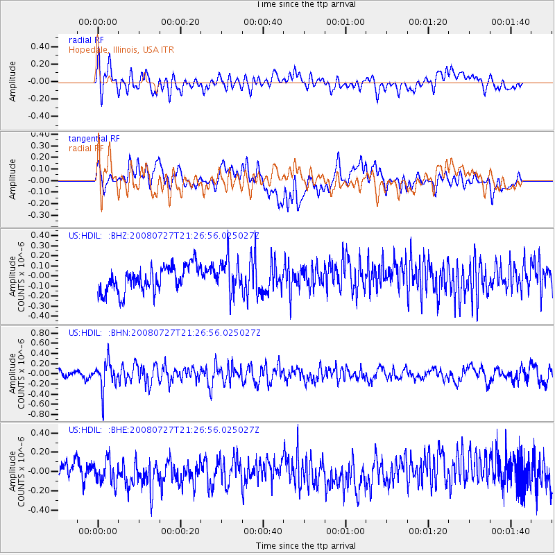
HDIL Hopedale, Illinois, USA - Earthquake Result Viewer
*The percent match for this event was below the threshold and hence no stack was calculated.
| Earthquake location: |
Central Mid-Atlantic Ridge |
| Earthquake latitude/longitude: |
-0.3/-18.3 |
| Earthquake time(UTC): |
2008/07/27 (209) 21:15:41 GMT |
| Earthquake Depth: |
10 km |
| Earthquake Magnitude: |
5.8 MB, 5.3 MS, 5.9 MW, 5.8 MW |
| Earthquake Catalog/Contributor: |
WHDF/NEIC |
|
| Network: |
US United States National Seismic Network |
| Station: |
HDIL Hopedale, Illinois, USA |
| Lat/Lon: |
40.56 N/89.29 W |
| Elevation: |
219 m |
|
| Distance: |
75.8 deg |
| Az: |
312.005 deg |
| Baz: |
102.771 deg |
| Ray Param: |
$rayparam |
*The percent match for this event was below the threshold and hence was not used in the summary stack. |
|
| Radial Match: |
50.025337 % |
| Radial Bump: |
400 |
| Transverse Match: |
48.094357 % |
| Transverse Bump: |
400 |
| SOD ConfigId: |
2504 |
| Insert Time: |
2010-03-05 03:00:41.495 +0000 |
| GWidth: |
2.5 |
| Max Bumps: |
400 |
| Tol: |
0.001 |
|
Signal To Noise
| Channel | StoN | STA | LTA |
| US:HDIL: :BHN:20080727T21:26:56.025027Z | 3.8855827 | 2.8540336E-7 | 7.345188E-8 |
| US:HDIL: :BHE:20080727T21:26:56.025027Z | 1.4372866 | 1.3047278E-7 | 9.077716E-8 |
| US:HDIL: :BHZ:20080727T21:26:56.025027Z | 1.3721141 | 1.7202586E-7 | 1.2537285E-7 |
| Arrivals |
| Ps | |
| PpPs | |
| PsPs/PpSs | |


