You are here: Home > Network List > US - United States National Seismic Network Stations List
> Station HDIL Hopedale, Illinois, USA > Earthquake Result Viewer
HDIL Hopedale, Illinois, USA - Earthquake Result Viewer
*The percent match for this event was below the threshold and hence no stack was calculated.
| Earthquake location: |
Kuril Islands |
| Earthquake latitude/longitude: |
49.9/156.4 |
| Earthquake time(UTC): |
2008/08/04 (217) 04:42:14 GMT |
| Earthquake Depth: |
77 km |
| Earthquake Magnitude: |
5.6 MB, 5.8 MW, 5.7 MW |
| Earthquake Catalog/Contributor: |
WHDF/NEIC |
|
| Network: |
US United States National Seismic Network |
| Station: |
HDIL Hopedale, Illinois, USA |
| Lat/Lon: |
40.56 N/89.29 W |
| Elevation: |
219 m |
|
| Distance: |
73.1 deg |
| Az: |
46.516 deg |
| Baz: |
321.946 deg |
| Ray Param: |
$rayparam |
*The percent match for this event was below the threshold and hence was not used in the summary stack. |
|
| Radial Match: |
71.0541 % |
| Radial Bump: |
400 |
| Transverse Match: |
67.61992 % |
| Transverse Bump: |
400 |
| SOD ConfigId: |
2504 |
| Insert Time: |
2010-03-05 03:00:42.685 +0000 |
| GWidth: |
2.5 |
| Max Bumps: |
400 |
| Tol: |
0.001 |
|
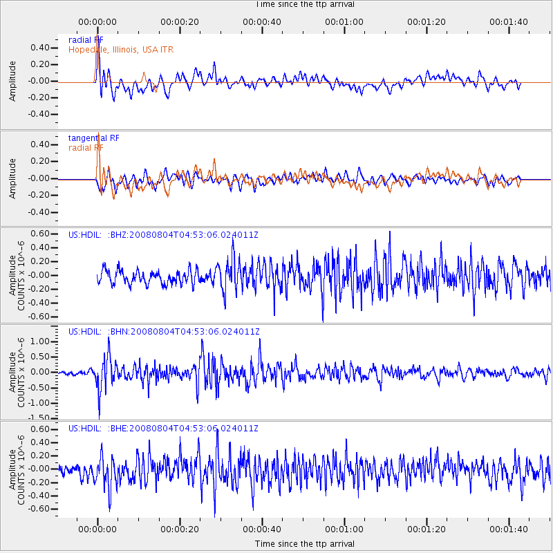
Signal To Noise
| Channel | StoN | STA | LTA |
| US:HDIL: :BHN:20080804T04:53:06.024011Z | 7.4708185 | 5.3367097E-7 | 7.143407E-8 |
| US:HDIL: :BHE:20080804T04:53:06.024011Z | 3.2408862 | 2.4478237E-7 | 7.552946E-8 |
| US:HDIL: :BHZ:20080804T04:53:06.024011Z | 2.4801648 | 2.35958E-7 | 9.5138034E-8 |
| Arrivals |
| Ps | |
| PpPs | |
| PsPs/PpSs | |


