You are here: Home > Network List > US - United States National Seismic Network Stations List
> Station HDIL Hopedale, Illinois, USA > Earthquake Result Viewer
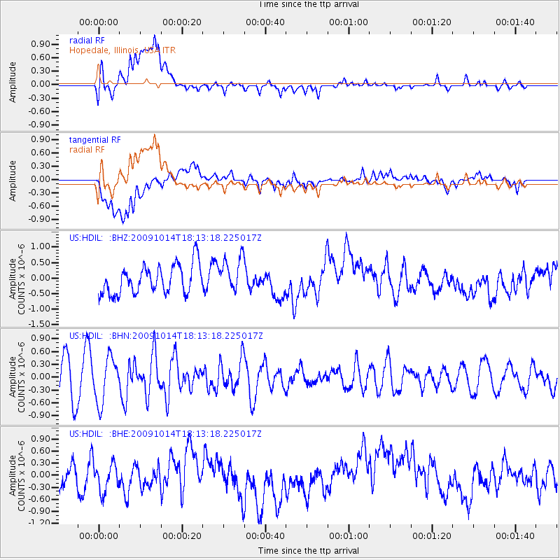
HDIL Hopedale, Illinois, USA - Earthquake Result Viewer
*The percent match for this event was below the threshold and hence no stack was calculated.
| Earthquake location: |
Samoa Islands Region |
| Earthquake latitude/longitude: |
-14.9/-174.8 |
| Earthquake time(UTC): |
2009/10/14 (287) 18:00:21 GMT |
| Earthquake Depth: |
10 km |
| Earthquake Magnitude: |
5.7 MB, 6.0 MS, 6.3 MW, 6.2 MW |
| Earthquake Catalog/Contributor: |
WHDF/NEIC |
|
| Network: |
US United States National Seismic Network |
| Station: |
HDIL Hopedale, Illinois, USA |
| Lat/Lon: |
40.56 N/89.29 W |
| Elevation: |
219 m |
|
| Distance: |
96.2 deg |
| Az: |
49.826 deg |
| Baz: |
255.814 deg |
| Ray Param: |
$rayparam |
*The percent match for this event was below the threshold and hence was not used in the summary stack. |
|
| Radial Match: |
50.093555 % |
| Radial Bump: |
400 |
| Transverse Match: |
41.682358 % |
| Transverse Bump: |
400 |
| SOD ConfigId: |
2622 |
| Insert Time: |
2010-03-05 03:01:03.076 +0000 |
| GWidth: |
2.5 |
| Max Bumps: |
400 |
| Tol: |
0.001 |
|
Signal To Noise
| Channel | StoN | STA | LTA |
| US:HDIL: :BHN:20091014T18:13:18.225017Z | 1.5636444 | 5.400165E-7 | 3.4535762E-7 |
| US:HDIL: :BHE:20091014T18:13:18.225017Z | 1.2332342 | 4.98808E-7 | 4.0447142E-7 |
| US:HDIL: :BHZ:20091014T18:13:18.225017Z | 1.20492 | 5.5776445E-7 | 4.6290577E-7 |
| Arrivals |
| Ps | |
| PpPs | |
| PsPs/PpSs | |


