You are here: Home > Network List > US - United States National Seismic Network Stations List
> Station HDIL Hopedale, Illinois, USA > Earthquake Result Viewer
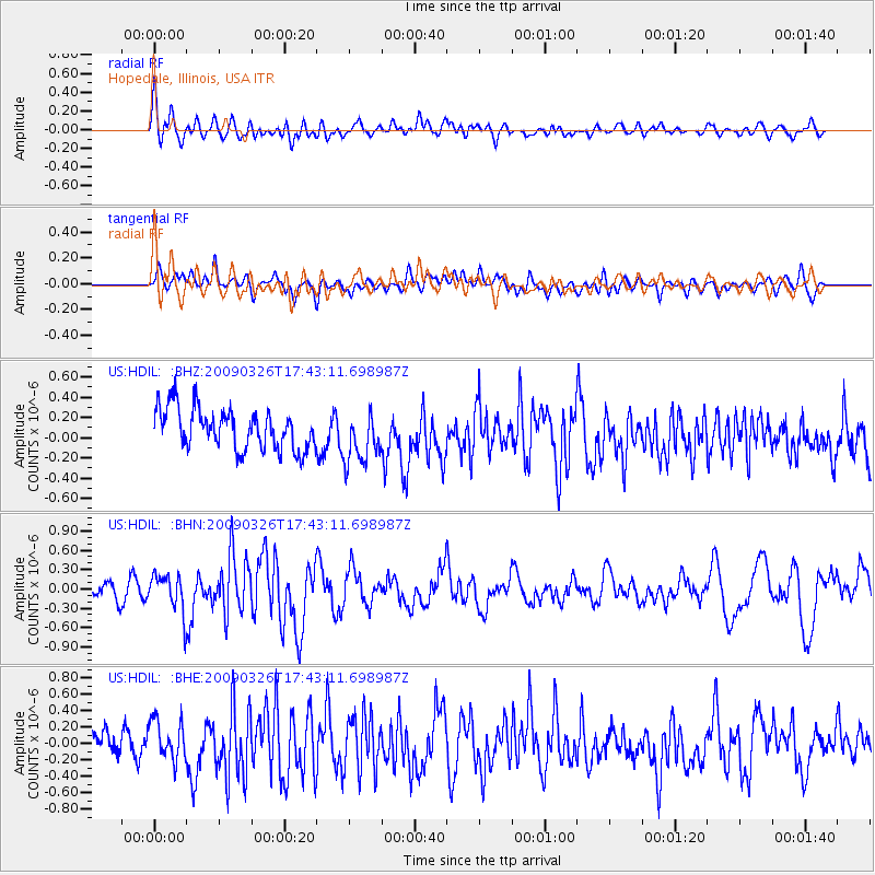
HDIL Hopedale, Illinois, USA - Earthquake Result Viewer
*The percent match for this event was below the threshold and hence no stack was calculated.
| Earthquake location: |
Near Coast Of Northern Peru |
| Earthquake latitude/longitude: |
-5.7/-81.3 |
| Earthquake time(UTC): |
2009/03/26 (085) 17:35:14 GMT |
| Earthquake Depth: |
10 km |
| Earthquake Magnitude: |
5.6 MB, 5.5 MS, 5.8 MW, 5.7 MW |
| Earthquake Catalog/Contributor: |
WHDF/NEIC |
|
| Network: |
US United States National Seismic Network |
| Station: |
HDIL Hopedale, Illinois, USA |
| Lat/Lon: |
40.56 N/89.29 W |
| Elevation: |
219 m |
|
| Distance: |
46.6 deg |
| Az: |
351.658 deg |
| Baz: |
169.077 deg |
| Ray Param: |
$rayparam |
*The percent match for this event was below the threshold and hence was not used in the summary stack. |
|
| Radial Match: |
54.420696 % |
| Radial Bump: |
400 |
| Transverse Match: |
44.39975 % |
| Transverse Bump: |
400 |
| SOD ConfigId: |
2658 |
| Insert Time: |
2010-03-05 03:01:23.206 +0000 |
| GWidth: |
2.5 |
| Max Bumps: |
400 |
| Tol: |
0.001 |
|
Signal To Noise
| Channel | StoN | STA | LTA |
| US:HDIL: :BHN:20090326T17:43:11.698987Z | 1.949625 | 2.9130908E-7 | 1.49418E-7 |
| US:HDIL: :BHE:20090326T17:43:11.698987Z | 1.498857 | 2.5006068E-7 | 1.6683424E-7 |
| US:HDIL: :BHZ:20090326T17:43:11.698987Z | 1.2948127 | 2.5842658E-7 | 1.9958608E-7 |
| Arrivals |
| Ps | |
| PpPs | |
| PsPs/PpSs | |


