You are here: Home > Network List > TA - USArray Transportable Network (new EarthScope stations) Stations List
> Station J26L Joseph Creek, AK, USA > Earthquake Result Viewer
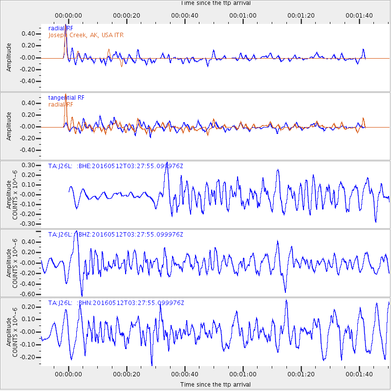
J26L Joseph Creek, AK, USA - Earthquake Result Viewer
*The percent match for this event was below the threshold and hence no stack was calculated.
| Earthquake location: |
Taiwan |
| Earthquake latitude/longitude: |
24.7/122.0 |
| Earthquake time(UTC): |
2016/05/12 (133) 03:17:16 GMT |
| Earthquake Depth: |
10 km |
| Earthquake Magnitude: |
5.6 MB |
| Earthquake Catalog/Contributor: |
NEIC PDE/NEIC COMCAT |
|
| Network: |
TA USArray Transportable Network (new EarthScope stations) |
| Station: |
J26L Joseph Creek, AK, USA |
| Lat/Lon: |
64.50 N/143.56 W |
| Elevation: |
1144 m |
|
| Distance: |
69.9 deg |
| Az: |
27.355 deg |
| Baz: |
285.035 deg |
| Ray Param: |
$rayparam |
*The percent match for this event was below the threshold and hence was not used in the summary stack. |
|
| Radial Match: |
79.38951 % |
| Radial Bump: |
353 |
| Transverse Match: |
75.1102 % |
| Transverse Bump: |
400 |
| SOD ConfigId: |
7422571 |
| Insert Time: |
2019-04-22 13:42:41.922 +0000 |
| GWidth: |
2.5 |
| Max Bumps: |
400 |
| Tol: |
0.001 |
|
Signal To Noise
| Channel | StoN | STA | LTA |
| TA:J26L: :BHZ:20160512T03:27:55.099976Z | 3.6410296 | 3.931208E-7 | 1.0796969E-7 |
| TA:J26L: :BHN:20160512T03:27:55.099976Z | 3.4231584 | 1.383993E-7 | 4.0430294E-8 |
| TA:J26L: :BHE:20160512T03:27:55.099976Z | 4.3121343 | 1.5896632E-7 | 3.686488E-8 |
| Arrivals |
| Ps | |
| PpPs | |
| PsPs/PpSs | |


