You are here: Home > Network List > UW - Pacific Northwest Regional Seismic Network Stations List
> Station MRBL Marblemount, WA, USA > Earthquake Result Viewer
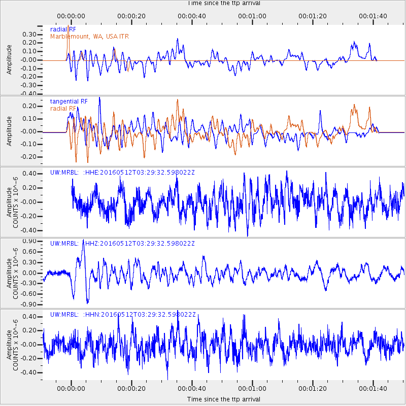
MRBL Marblemount, WA, USA - Earthquake Result Viewer
*The percent match for this event was below the threshold and hence no stack was calculated.
| Earthquake location: |
Taiwan |
| Earthquake latitude/longitude: |
24.7/122.0 |
| Earthquake time(UTC): |
2016/05/12 (133) 03:17:16 GMT |
| Earthquake Depth: |
10 km |
| Earthquake Magnitude: |
5.6 MB |
| Earthquake Catalog/Contributor: |
NEIC PDE/NEIC COMCAT |
|
| Network: |
UW Pacific Northwest Regional Seismic Network |
| Station: |
MRBL Marblemount, WA, USA |
| Lat/Lon: |
48.52 N/121.48 W |
| Elevation: |
75 m |
|
| Distance: |
87.7 deg |
| Az: |
36.529 deg |
| Baz: |
305.466 deg |
| Ray Param: |
$rayparam |
*The percent match for this event was below the threshold and hence was not used in the summary stack. |
|
| Radial Match: |
58.538242 % |
| Radial Bump: |
400 |
| Transverse Match: |
60.320946 % |
| Transverse Bump: |
400 |
| SOD ConfigId: |
7422571 |
| Insert Time: |
2019-04-22 13:43:31.257 +0000 |
| GWidth: |
2.5 |
| Max Bumps: |
400 |
| Tol: |
0.001 |
|
Signal To Noise
| Channel | StoN | STA | LTA |
| UW:MRBL: :HHZ:20160512T03:29:32.598022Z | 4.4370584 | 4.6184047E-7 | 1.04087086E-7 |
| UW:MRBL: :HHN:20160512T03:29:32.598022Z | 0.9328035 | 1.1476904E-7 | 1.2303667E-7 |
| UW:MRBL: :HHE:20160512T03:29:32.598022Z | 1.1110106 | 1.5404792E-7 | 1.3865568E-7 |
| Arrivals |
| Ps | |
| PpPs | |
| PsPs/PpSs | |


