You are here: Home > Network List > CN - Canadian National Seismograph Network Stations List
> Station INK INUVIK, NT > Earthquake Result Viewer
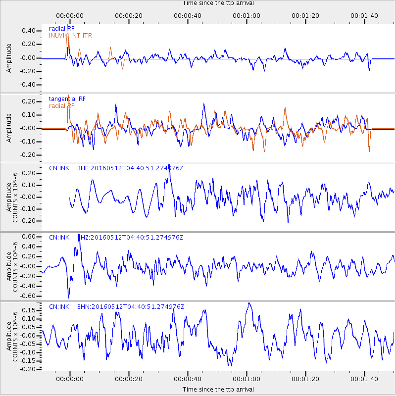
INK INUVIK, NT - Earthquake Result Viewer
*The percent match for this event was below the threshold and hence no stack was calculated.
| Earthquake location: |
Taiwan Region |
| Earthquake latitude/longitude: |
24.7/122.0 |
| Earthquake time(UTC): |
2016/05/12 (133) 04:29:56 GMT |
| Earthquake Depth: |
10 km |
| Earthquake Magnitude: |
5.5 MB |
| Earthquake Catalog/Contributor: |
NEIC PDE/NEIC COMCAT |
|
| Network: |
CN Canadian National Seismograph Network |
| Station: |
INK INUVIK, NT |
| Lat/Lon: |
68.31 N/133.53 W |
| Elevation: |
44 m |
|
| Distance: |
72.5 deg |
| Az: |
22.184 deg |
| Baz: |
292.5 deg |
| Ray Param: |
$rayparam |
*The percent match for this event was below the threshold and hence was not used in the summary stack. |
|
| Radial Match: |
62.226166 % |
| Radial Bump: |
400 |
| Transverse Match: |
66.89154 % |
| Transverse Bump: |
400 |
| SOD ConfigId: |
7422571 |
| Insert Time: |
2019-04-22 13:47:39.168 +0000 |
| GWidth: |
2.5 |
| Max Bumps: |
400 |
| Tol: |
0.001 |
|
Signal To Noise
| Channel | StoN | STA | LTA |
| CN:INK: :BHZ:20160512T04:40:51.274976Z | 5.395168 | 3.5313238E-7 | 6.5453456E-8 |
| CN:INK: :BHN:20160512T04:40:51.274976Z | 0.9907292 | 5.8582174E-8 | 5.9130354E-8 |
| CN:INK: :BHE:20160512T04:40:51.274976Z | 2.0162084 | 1.3115991E-7 | 6.505275E-8 |
| Arrivals |
| Ps | |
| PpPs | |
| PsPs/PpSs | |


