You are here: Home > Network List > TA - USArray Transportable Network (new EarthScope stations) Stations List
> Station M31M Drury Creek, Yukon, CA > Earthquake Result Viewer
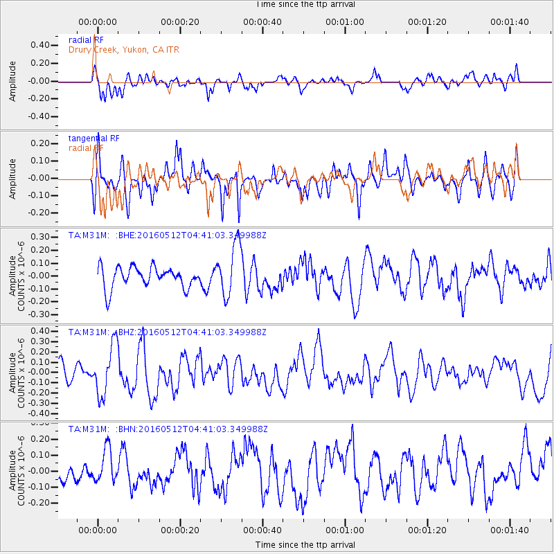
M31M Drury Creek, Yukon, CA - Earthquake Result Viewer
*The percent match for this event was below the threshold and hence no stack was calculated.
| Earthquake location: |
Taiwan Region |
| Earthquake latitude/longitude: |
24.7/122.0 |
| Earthquake time(UTC): |
2016/05/12 (133) 04:29:56 GMT |
| Earthquake Depth: |
10 km |
| Earthquake Magnitude: |
5.5 MB |
| Earthquake Catalog/Contributor: |
NEIC PDE/NEIC COMCAT |
|
| Network: |
TA USArray Transportable Network (new EarthScope stations) |
| Station: |
M31M Drury Creek, Yukon, CA |
| Lat/Lon: |
62.20 N/134.39 W |
| Elevation: |
639 m |
|
| Distance: |
74.5 deg |
| Az: |
28.219 deg |
| Baz: |
293.43 deg |
| Ray Param: |
$rayparam |
*The percent match for this event was below the threshold and hence was not used in the summary stack. |
|
| Radial Match: |
55.90782 % |
| Radial Bump: |
400 |
| Transverse Match: |
58.09123 % |
| Transverse Bump: |
400 |
| SOD ConfigId: |
7422571 |
| Insert Time: |
2019-04-22 13:50:57.739 +0000 |
| GWidth: |
2.5 |
| Max Bumps: |
400 |
| Tol: |
0.001 |
|
Signal To Noise
| Channel | StoN | STA | LTA |
| TA:M31M: :BHZ:20160512T04:41:03.349988Z | 2.6464384 | 2.533328E-7 | 9.572594E-8 |
| TA:M31M: :BHN:20160512T04:41:03.349988Z | 1.4352165 | 1.0908735E-7 | 7.600759E-8 |
| TA:M31M: :BHE:20160512T04:41:03.349988Z | 2.6690512 | 2.1451713E-7 | 8.0372054E-8 |
| Arrivals |
| Ps | |
| PpPs | |
| PsPs/PpSs | |


