AMTX Amarillo, Texas, USA - Earthquake Result Viewer
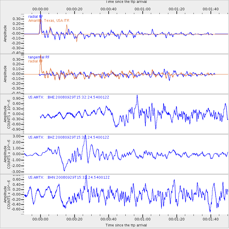
Earthquake location: Kermadec Islands, New Zealand
Earthquake latitude/longitude: -29.8/-177.7
Earthquake time(UTC): 2008/09/29 (273) 15:19:31 GMT
Earthquake Depth: 36 km
Earthquake Magnitude: 6.5 MB, 6.7 MS, 7.0 MW, 7.0 MW
Earthquake Catalog/Contributor: WHDF/NEIC
Network: US United States National Seismic Network
Station: AMTX Amarillo, Texas, USA
Lat/Lon: 34.53 N/101.41 W
Elevation: 1010 m
Distance: 96.2 deg
Az: 53.781 deg
Baz: 238.184 deg
Ray Param: 0.04055906
Estimated Moho Depth: 15.75 km
Estimated Crust Vp/Vs: 1.81
Assumed Crust Vp: 6.426 km/s
Estimated Crust Vs: 3.545 km/s
Estimated Crust Poisson's Ratio: 0.28
Radial Match: 80.51838 %
Radial Bump: 400
Transverse Match: 67.56512 %
Transverse Bump: 400
SOD ConfigId: 2560
Insert Time: 2010-03-05 03:03:00.860 +0000
GWidth: 2.5
Max Bumps: 400
Tol: 0.001

Signal To Noise

ChannelStoNSTALTA
US:AMTX: :BHZ:20080929T15:32:24.540012Z4.806275.1615405E-71.07391806E-7
US:AMTX: :BHN:20080929T15:32:24.540012Z1.37425351.6669634E-71.2129956E-7
US:AMTX: :BHE:20080929T15:32:24.540012Z2.41681742.489225E-71.0299599E-7
Arrivals
Ps2.0 SECOND
PpPs6.8 SECOND
PsPs/PpSs8.8 SECOND