You are here: Home > Network List > US - United States National Seismic Network Stations List
> Station AMTX Amarillo, Texas, USA > Earthquake Result Viewer
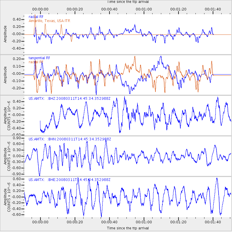
AMTX Amarillo, Texas, USA - Earthquake Result Viewer
*The percent match for this event was below the threshold and hence no stack was calculated.
| Earthquake location: |
Fox Islands, Aleutian Islands |
| Earthquake latitude/longitude: |
52.2/-169.5 |
| Earthquake time(UTC): |
2008/03/11 (071) 14:37:10 GMT |
| Earthquake Depth: |
16 km |
| Earthquake Magnitude: |
5.5 MB, 5.3 MS, 5.6 MW, 5.5 MW |
| Earthquake Catalog/Contributor: |
WHDF/NEIC |
|
| Network: |
US United States National Seismic Network |
| Station: |
AMTX Amarillo, Texas, USA |
| Lat/Lon: |
34.53 N/101.41 W |
| Elevation: |
1010 m |
|
| Distance: |
50.6 deg |
| Az: |
82.222 deg |
| Baz: |
312.344 deg |
| Ray Param: |
$rayparam |
*The percent match for this event was below the threshold and hence was not used in the summary stack. |
|
| Radial Match: |
57.466003 % |
| Radial Bump: |
400 |
| Transverse Match: |
64.26031 % |
| Transverse Bump: |
400 |
| SOD ConfigId: |
2504 |
| Insert Time: |
2010-03-05 03:03:25.207 +0000 |
| GWidth: |
2.5 |
| Max Bumps: |
400 |
| Tol: |
0.001 |
|
Signal To Noise
| Channel | StoN | STA | LTA |
| US:AMTX: :BHN:20080311T14:45:34.352988Z | 2.3718112 | 4.7680564E-7 | 2.0103019E-7 |
| US:AMTX: :BHE:20080311T14:45:34.352988Z | 0.79541445 | 1.3063807E-7 | 1.6423898E-7 |
| US:AMTX: :BHZ:20080311T14:45:34.352988Z | 0.6462167 | 1.3896572E-7 | 2.1504508E-7 |
| Arrivals |
| Ps | |
| PpPs | |
| PsPs/PpSs | |


