You are here: Home > Network List > IW - Intermountain West Stations List
> Station PLID Pearl Lake, Idaho, USA > Earthquake Result Viewer
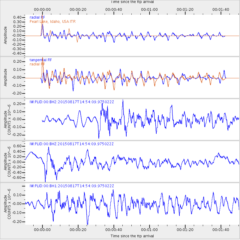
PLID Pearl Lake, Idaho, USA - Earthquake Result Viewer
*The percent match for this event was below the threshold and hence no stack was calculated.
| Earthquake location: |
Mariana Islands Region |
| Earthquake latitude/longitude: |
21.9/146.6 |
| Earthquake time(UTC): |
2015/08/17 (229) 14:42:32 GMT |
| Earthquake Depth: |
3.1 km |
| Earthquake Magnitude: |
5.6 MWB |
| Earthquake Catalog/Contributor: |
NEIC PDE/NEIC COMCAT |
|
| Network: |
IW Intermountain West |
| Station: |
PLID Pearl Lake, Idaho, USA |
| Lat/Lon: |
45.09 N/116.00 W |
| Elevation: |
2164 m |
|
| Distance: |
79.8 deg |
| Az: |
45.558 deg |
| Baz: |
290.646 deg |
| Ray Param: |
$rayparam |
*The percent match for this event was below the threshold and hence was not used in the summary stack. |
|
| Radial Match: |
65.35392 % |
| Radial Bump: |
400 |
| Transverse Match: |
62.204994 % |
| Transverse Bump: |
400 |
| SOD ConfigId: |
1085051 |
| Insert Time: |
2015-08-31 15:12:20.904 +0000 |
| GWidth: |
2.5 |
| Max Bumps: |
400 |
| Tol: |
0.001 |
|
Signal To Noise
| Channel | StoN | STA | LTA |
| IW:PLID:00:BHZ:20150817T14:54:09.975022Z | 1.8356167 | 3.214086E-7 | 1.750957E-7 |
| IW:PLID:00:BH1:20150817T14:54:09.975022Z | 0.91584975 | 4.289364E-8 | 4.6834796E-8 |
| IW:PLID:00:BH2:20150817T14:54:09.975022Z | 2.5925546 | 1.1036425E-7 | 4.256969E-8 |
| Arrivals |
| Ps | |
| PpPs | |
| PsPs/PpSs | |


