You are here: Home > Network List > US - United States National Seismic Network Stations List
> Station AMTX Amarillo, Texas, USA > Earthquake Result Viewer
AMTX Amarillo, Texas, USA - Earthquake Result Viewer
*The percent match for this event was below the threshold and hence no stack was calculated.
| Earthquake location: |
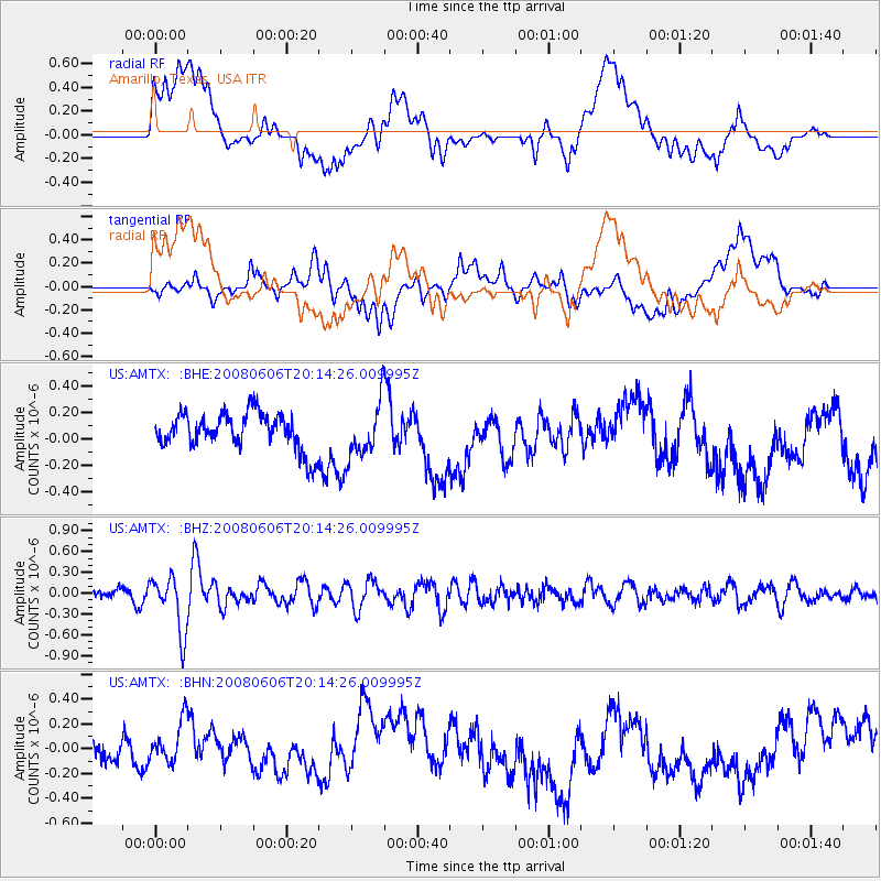
Northern Algeria |
| Earthquake latitude/longitude: |
35.9/-0.7 |
| Earthquake time(UTC): |
2008/06/06 (158) 20:02:56 GMT |
| Earthquake Depth: |
4.0 km |
| Earthquake Magnitude: |
5.5 MB, 5.3 MS, 5.5 MW, 5.5 MW |
| Earthquake Catalog/Contributor: |
WHDF/NEIC |
|
| Network: |
US United States National Seismic Network |
| Station: |
AMTX Amarillo, Texas, USA |
| Lat/Lon: |
34.53 N/101.41 W |
| Elevation: |
1010 m |
|
| Distance: |
78.2 deg |
| Az: |
304.048 deg |
| Baz: |
54.587 deg |
| Ray Param: |
$rayparam |
*The percent match for this event was below the threshold and hence was not used in the summary stack. |
|
| Radial Match: |
37.725655 % |
| Radial Bump: |
400 |
| Transverse Match: |
31.987114 % |
| Transverse Bump: |
400 |
| SOD ConfigId: |
2504 |
| Insert Time: |
2010-03-05 03:04:12.710 +0000 |
| GWidth: |
2.5 |
| Max Bumps: |
400 |
| Tol: |
0.001 |
|
Signal To Noise
| Channel | StoN | STA | LTA |
| US:AMTX: :BHZ:20080606T20:14:26.009995Z | 4.994237 | 4.0137326E-7 | 8.036728E-8 |
| US:AMTX: :BHN:20080606T20:14:26.009995Z | 0.82608783 | 1.589276E-7 | 1.9238584E-7 |
| US:AMTX: :BHE:20080606T20:14:26.009995Z | 1.5495032 | 2.147828E-7 | 1.3861397E-7 |
| Arrivals |
| Ps | |
| PpPs | |
| PsPs/PpSs | |


