You are here: Home > Network List > US - United States National Seismic Network Stations List
> Station AMTX Amarillo, Texas, USA > Earthquake Result Viewer
AMTX Amarillo, Texas, USA - Earthquake Result Viewer
*The percent match for this event was below the threshold and hence no stack was calculated.
| Earthquake location: |
Kuril Islands |
| Earthquake latitude/longitude: |
46.5/153.3 |
| Earthquake time(UTC): |
2008/06/23 (175) 12:32:12 GMT |
| Earthquake Depth: |
10 km |
| Earthquake Magnitude: |
5.6 MB, 5.2 MS, 5.6 MW, 5.6 MW |
| Earthquake Catalog/Contributor: |
WHDF/NEIC |
|
| Network: |
US United States National Seismic Network |
| Station: |
AMTX Amarillo, Texas, USA |
| Lat/Lon: |
34.53 N/101.41 W |
| Elevation: |
1010 m |
|
| Distance: |
75.1 deg |
| Az: |
55.481 deg |
| Baz: |
316.4 deg |
| Ray Param: |
$rayparam |
*The percent match for this event was below the threshold and hence was not used in the summary stack. |
|
| Radial Match: |
57.133205 % |
| Radial Bump: |
400 |
| Transverse Match: |
57.498665 % |
| Transverse Bump: |
400 |
| SOD ConfigId: |
2504 |
| Insert Time: |
2010-03-05 03:04:17.929 +0000 |
| GWidth: |
2.5 |
| Max Bumps: |
400 |
| Tol: |
0.001 |
|
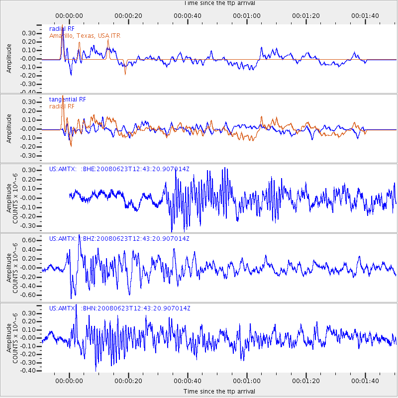
Signal To Noise
| Channel | StoN | STA | LTA |
| US:AMTX: :BHZ:20080623T12:43:20.907014Z | 8.115229 | 3.8359843E-7 | 4.726896E-8 |
| US:AMTX: :BHN:20080623T12:43:20.907014Z | 2.1113086 | 1.2848949E-7 | 6.085775E-8 |
| US:AMTX: :BHE:20080623T12:43:20.907014Z | 2.7279506 | 1.5141775E-7 | 5.5506046E-8 |
| Arrivals |
| Ps | |
| PpPs | |
| PsPs/PpSs | |


