You are here: Home > Network List > US - United States National Seismic Network Stations List
> Station AMTX Amarillo, Texas, USA > Earthquake Result Viewer
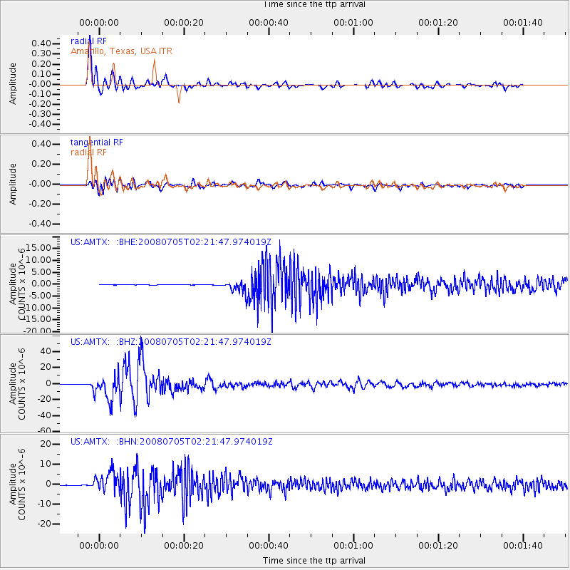
AMTX Amarillo, Texas, USA - Earthquake Result Viewer
*The percent match for this event was below the threshold and hence no stack was calculated.
| Earthquake location: |
Sea Of Okhotsk |
| Earthquake latitude/longitude: |
53.9/152.9 |
| Earthquake time(UTC): |
2008/07/05 (187) 02:12:04 GMT |
| Earthquake Depth: |
633 km |
| Earthquake Magnitude: |
6.8 MB, 7.7 MW, 7.7 MW |
| Earthquake Catalog/Contributor: |
WHDF/NEIC |
|
| Network: |
US United States National Seismic Network |
| Station: |
AMTX Amarillo, Texas, USA |
| Lat/Lon: |
34.53 N/101.41 W |
| Elevation: |
1010 m |
|
| Distance: |
71.2 deg |
| Az: |
57.1 deg |
| Baz: |
322.981 deg |
| Ray Param: |
$rayparam |
*The percent match for this event was below the threshold and hence was not used in the summary stack. |
|
| Radial Match: |
97.06883 % |
| Radial Bump: |
400 |
| Transverse Match: |
89.78232 % |
| Transverse Bump: |
400 |
| SOD ConfigId: |
2504 |
| Insert Time: |
2010-03-05 03:04:19.329 +0000 |
| GWidth: |
2.5 |
| Max Bumps: |
400 |
| Tol: |
0.001 |
|
Signal To Noise
| Channel | StoN | STA | LTA |
| US:AMTX: :BHZ:20080705T02:21:47.974019Z | 94.357925 | 1.5231493E-5 | 1.614225E-7 |
| US:AMTX: :BHN:20080705T02:21:47.974019Z | 47.84349 | 5.219416E-6 | 1.0909355E-7 |
| US:AMTX: :BHE:20080705T02:21:47.974019Z | 52.108097 | 4.4424237E-6 | 8.5253994E-8 |
| Arrivals |
| Ps | |
| PpPs | |
| PsPs/PpSs | |


